Greenwich Park is a former hunting park in Greenwich and one of the largest single green spaces in south east London. One of the Royal Parks of London, and the first to be enclosed (in 1433), it covers 183 acres (0.7 km2) and is part of the Greenwich World Heritage Site. It commands fine views over the River Thames, Isle of Dogs and the City of London. The park is open from 06:00 for pedestrians (and 07:00 for traffic) all year round and closes at dusk.
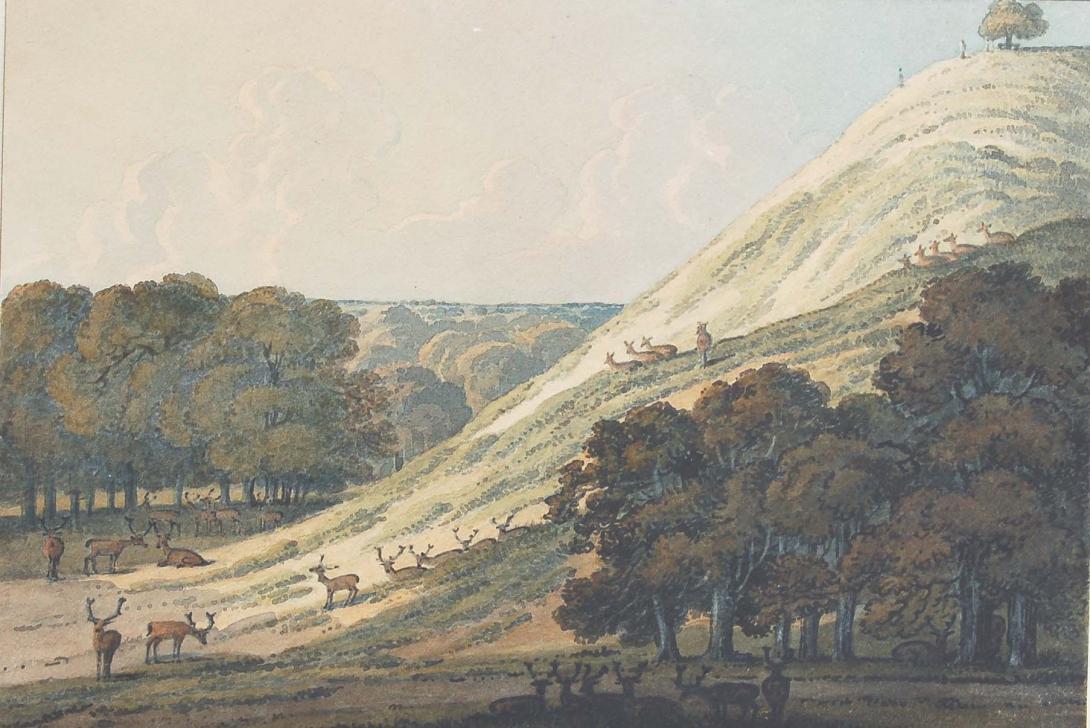
The estate of some 200 acres (0.81 km2) was originally owned by the Abbey of St. Peter at Ghent, but reverted to the Crown in 1427 and was given by Henry VI to his uncle Humphrey, Duke of Gloucester (Barker 1999). He built a house by the river, Bella Court, and a small castle, Duke Humphrey’s Tower, on the hill. The former evolved first into the Tudor Palace of Placentia and then into the Queen's House and Greenwich Hospital. The castle, by now in disrepair, was chosen for the site of the Royal Observatory by Charles II in 1675. In the 15th century the park was mostly heathland and probably used for hawking. In the next century, deer were introduced by Henry VIII for hunting, and a small collection of deer is maintained today in an area to the south east. James I enclosed the park with a brick wall, twelve feet high and two miles (3 km) long at a cost of £2000, much of which remains and defines the modern boundary.
In the 17th century, the park was landscaped, possibly by André Le Nôtre who is known at least to have designed plans for it. The public were first allowed into the park during the 18th century. Samuel Johnson visited the park in 1763 and commented “Is it not fine?”. The famous hill to the north of the observatory was used on public holidays for mass ‘tumbling’.In the 1830s a railway was nearly driven through the middle of the lower park on a viaduct but the scheme was defeated by intense local opposition. However, the London and Greenwich Railway was later extended beneath the ground via a cut-and-cover tunnel link between Greenwich and Maze Hill which opened in 1878 (the tunnel alignment is on the north side of the northern side of the park's boundary wall, running beneath the gardens of the National Maritime Museum and Queen's House). In 1888 the park got a station of its own when Greenwich Park railway station was opened. The station was not successful, with most passengers preferring the older Greenwich station and in 1917 Greenwich Park station and the line it ran on closed down.
The park is roughly rectangular in plan with sides 1000 metres by 750 metres and oriented with the long sides lying NNW to SSE. In what follows this direction is taken to be N to S for ease of exposition. It is located at grid reference TQ390772. The park stretches along a hillside and is on two levels. The lower level (closest to the Museum, Queen's House and, beyond them, the Thames) lies to the north; after a steep walk uphill, there is a flat expanse that is, essentially, an enclosed extension of the plateau of Blackheath. Roughly in the centre, on the top is the hill, is the Royal Observatory, Greenwich. To the north is the National Maritime Museum and Queen's House, and beyond those Greenwich Hospital. To the east is Vanbrugh Castle. To the south is Blackheath and in the south western corner is the Ranger's House, looking out over heath. To the west lie the architecturally fine streets of Chesterfield Walk and Croom’s Hill (Pevsner 1983). The Observatory is on the top of the hill. Outside is a statue of General James Wolfe in a small plaza from which there are majestic views across to the former Greenwich Hospital (later the Royal Naval College and now the University of Greenwich) and then towards the river, the skyscrapers of Canary Wharf, the City of London to the northwest and the Millennium Dome to the north.