" P Yates" and inscribed on the reverse
The Isle of Ulva was named by the Vikings as Ullfur or, translated as, Wolf Island. They may have indeed seen Wolves on the island, but it didn't stop them seeing the island as an ideal place to settle.
Ulva was privately owned by the Howard family until the 21st of June 2018, It is now owned by a community group from the North West of Mull (North West Mull Community Woodland Company). The 'buy out' was publicly funded to take over the whole of Ulva. ( The 'buy out' was controversial, both locally and, with the Howard faminly. ( Read his comments )
The Isle of Ulva was, in past years, the home of 600 people, who made their living from the collection and exportation of kelp. Today there are under 20 residents who make a living from sheep and cattle farming, fish farming, oyster farming and tourism.
There are no tarmac roads on Ulva, so no cars, just the 4 wheel cross country bikes used by all inhabitants, young and old. The new owners are dedicated to creating a balance between the needs of the community and the preservation of one of Scotland's most unique, beautiful and accessible islands.
Ulva's woodlands, shores and open moors make it an ideal place for bird watching. Bird activity is intense throughout the year. There are exciting seasonal events - the coming of the terns to the small islands south of Ulva to breed, the puffins in the waters west and north of Ulva in early summer, the occasional cry of the Corncrake.
The animals and plants you see on a visit to Ulva will depend upon three things: the time of year, your powers of observation and pure luck. Red deer, rabbits and mountain hares, the occasional sea otter, stoat or hedgehog might be spotted at any season. A researcher from Leeds University studying the habits of otters managed to see them every evening for six weeks in the summer of 1986 along the south shore of Ulva.
Ulva is open from Easter to October; the ferry which takes foot passengers and bicycles runs Monday to Friday 9 - 5. The crossing only takes a couple of minutes and is on demand; summon the ferry by uncovering the red panel on the pier but don't forget to cover it again as the boat approaches. The island is closed on Saturdays but opens on Sundays from June to the end of August.
Ulva is home to Sheila's Cottage, a restored thatched croft house once the home of Sheila MacFadyen. (Read more) Mull Magic offers regular walking tours on Ulva with pick-ups in Tobermory and Salen. The cost includes the ferry to Ulva and entry to the island, packed lunch and afternoon tea in the Boathouse.
Ulva had it's own Parliamentary church which was one of five churches on Mull and Iona to be designed by Thomas Telford and was completed, along with the manse, in 1828. In the mid 1950s Lady Congleton who owned the island purchased the church and the larger partof it was converted into a community hall. Only the north west portion was retained for ecclesiastical use. The church is now privately owed and a couple of services are conducted every year at Easter and Harvest time
Ulva (/ˈʌlvə/; Scottish Gaelic: Ulbha) is a small island in the Inner Hebrides of Scotland, off the west coast of Mull. It is separated from Mull by a narrow strait, and connected to the neighbouring island of Gometra by a bridge. Much of the island is formed from Cenozoic basalt rocks, which are formed into columns in places.
Ulva has been populated since the Mesolithic and there are various Neolithic remains on the island. The Norse occupation of the island in the Early Middle Ages has left few tangible artefacts but did bequeath the island its name, which is probably from Ulvoy, meaning "wolf island". Celtic culture was a major influence during both Pictish and Dalriadan times as well as the post-Norse period when the islands became part of modern Scotland. This long period, when Gaelic became the dominant language, was ended by the 19th-century Clearances. At its height, Ulva had a population of over 800, but by May 2019, this had declined to 5; some increase in the number of residents was expected in future, with the re-population plan that was to commence in 2020.
Numerous well-known individuals have connections with the island including David Livingstone, Samuel Johnson and Walter Scott, who drew inspiration from Ulva for his 1815 poem, The Lord of the Isles. Wildlife is abundant: cetaceans are regularly seen in the surrounding waters and over 500 species of plant have been recorded. Today there is a regular ferry service and tourism is the mainstay of the economy. In March 2018 the Scottish Land Fund pledged £4.4 million towards a community buyout of the island, and the North West Mull Community Woodland Company took ownership of the island on 21 June 2018.
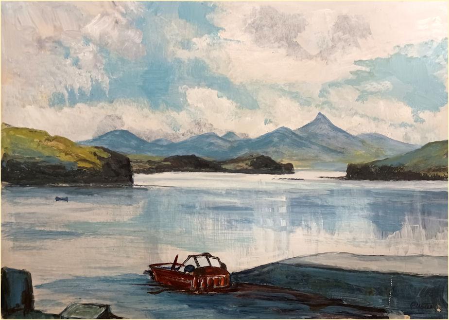
Ulva is roughly oval in shape with an indented coastline. It is aligned east-west, being 12 kilometres (7+1⁄2 miles) long, and 4 kilometres (2+1⁄2 miles) wide. Viewed on a small scale, Ulva and its neighbouring island Gometra appear to be a peninsula of the Isle of Mull, as they are separated from one another by narrow straits. Caolas Ulbha (the Sound of Ulva) at the east of the island is a narrow channel a few hundred metres across to Ulva Ferry on Mull. To its west, it is separated from Gometra by Gometra Harbour. To the south are Mull's headlands of Ardmeanach and the Ross of Mull. To the north, Loch Tuath (Loch-a-Tuath) separates it from another headland of Mull, and to the south east is Loch na Keal (Loch nan Ceall), and the island of Eorsa. There are two main bays on the south coast, Port a' Bhàta, and Tràigh Bhàn. On the north coast, there is the horseshoe bay of Lòn Bhearnuis (Bearnus lagoon), Soriby Bay and a few minor inlets.
The highest point of Ulva is Beinn Chreagach ("rocky mountain"), which reaches 313 m (1,027 ft). It has a neighbour in Beinn Eoligarry the summit of which is 306 m (1,004 ft) above sea level. The island has a central ridge, with the highest ground running along its lateral axis - this ridge is somewhat broken by Gleann Glas and some other valleys. The south east peninsula tends to be lower lying, with a small plain along the south coast, consisting of raised beaches.
The climate is moderated by the Gulf Stream.
Parish and region
Ulva was part of Argyll pre-1974, and Strathclyde Region after that. It is now part of Argyll and Bute.
The island is in the parish of Kilninian (Cill Ninein), which also includes Gometra, Staffa, Little Colonsay and part of the west of Mull. It was united with Kilmore on Mull, and the minister has traditionally preached in Kilninian and Kilmore on alternate Sundays. For more details, see the church section.
Surrounding islands
A view from Ormaig to the south east: the nearer islets are Geasgill Mòr & Geasgill Beag, while the longer island behind them is Inch Kenneth
Gometra is a tidal island and connected to Ulva by a bridge. Little Colonsay and Inchkenneth (with Samalan Island) are to Ulva's south west and south east respectively. Further to the west are the Treshnish Isles, including the distinctive Bac Mòr, and beyond them, the larger islands of Coll and Tiree, with Gunna between them. To the south west are the islands of Staffa, of Fingal's Cave fame and Erisgeir. Much further to the south west is the island of Iona.
There are a number of smaller islets and rocks off Ulva. To the south and the east are Eilean na Creiche (listed as "Eilean na Craoibhe", on the island's guide's map.)[11] between Little Colonsay and Ulva. Off Port a' Bhàta are Geasgill Beag & Geasgill Mòr, between Ulva and Inchkenneth. To the south west is Sgeir na Sgeireadh, and Màisgeir due south of Gometra. These islands, along with Ulva itself, form part of the Loch na Keal National Scenic Area, one of the forty national scenic areas in Scotland, which are defined so as to identify areas of exceptional scenery and to ensure its protection from inappropriate development.
Geology
Basalt cliffs, near Dùn Bhioramuill on south coast
Topography of Ulva and surrounding areaUlva's interior is moorland, while the spectacular geological formations of the south coast, have been somewhat overshadowed by those of its neighbour Staffa. Nonetheless, they are still renowned in their own right. Around 60 million years ago, the region was volcanically active, with Ben More on Mull being the remnant of a volcano, and it was in this period that the famous rock formations of Staffa and the basaltic columns of "The Castles" on Ulva came into being. The lava flows are known as the "Staffa Magma Type member" and can also be seen on Mull at Carsaig, Ardtum, and near Tobermory on its east coast. They are particularly rich in silica. These were formed when the cooling surface of the mass of hot lava cracked in a hexagonal pattern in a similar way to drying mud cracking as it shrinks, and these cracks gradually extended down into the mass of lava as it cooled and shrank to form the columns which were subsequently exposed by erosion.
Much more recently, Ulva was subjected to glaciation, which dug out the fjords/sea lochs on its north and south east sides – Loch Tuath (meaning simply "north loch") and Loch na Keal, as well as softening some of its sharper edges.
The Hebridean coastline has been subject to significant post-glacial changes in sea level and the area is rising up at about 2 mm (1⁄16 in) per annum as isostatic equilibrium is regained. The relative drop in sea-level has left the highest raised sea cave in the British Isles on Ulva at A' Chrannag. At some point, Ulva was probably a west pointing headland of Mull, connected to Gometra and Eilean Dioghlum off the latter's west coast.
The derivation of "Ulva" is not certain, but is probably from the Old Norse for "wolf isle". Samuel Johnson deduced that it was probably not Gaelic in origin:
[sic] The name is supposed to be a depravation of some other; for the Earse language does not afford it any etymology.
The English name "Ulva" is from the Scottish Gaelic, Ulbha, but this may have been corruption of Old Norse. It is debatable whether the Norse root Ulfr refers to an individual's name, or to the animal itself (possibly because of the shape of the island). The island's official website and guide book claims -
A scout, sent ashore from the longboat is alleged to have reported, "Ullamhdha", Viking for "Nobody home".
However ullamhdha is not Norse, but appears to be the Scottish Gaelic for "ready for it". Munro and MacQuarrie (1996) state that the scout said "ullamh dha" ([ˈulˠ̪əv ɣa]) in Gaelic, meaning the island "was ready for occupation".
The Old Statistical Account of Scotland mentions an alternative folk etymology, namely that Ulva comes from ullamh-àth ([ˈulˠ̪əv aː]) meaning 'ready ford' in Gaelic, that could refer either to the tidal stretch with Gometra, or the Sound of Ulva over which cattle were sometimes swum.
History
Ulva has been inhabited since prehistoric times
"VLWA" and surrounding islands from Blaeu's Atlas Maior (1654)
Ulva's human history goes back thousands of years. Its standing stones have been dated to 1500 BC, and a shell midden in Livingstones Cave dates to c. 5650 BC; it includes remains of flint and a human infant, as well as fauna more appropriate to the Ice Age, such as lemming and Arctic fox (Alopex lagopus). The cave has been excavated since 1987 by archaeologists from the University of Edinburgh.
There are a number of dolmens and standing stones on the island, including some west of Cragaig, and one north east of Ormaig, as well as dùns such as Dùn Bhioramuill on the south east slope of A' Chrannag near Cùl a' Gheata above the cliffs, and Dùn Iosagain on the south west slope of Beinn Eolasary.
Dál Riata
Ulva was anciently part of the border zone of the kingdom of Dál Riata, and during this period the old Gaelic language first came to be spoken here. Presumably the area formed part of the Pictish lands, but they left little evidence behind. This region was amongst the first in northern Scotland to become Christianised. This is commemorated in some of the local place names which contain the word "Cill" or "Ceall", which is frequently anglicised as "Kil-" e.g. "Loch na Keal" is Loch nan Ceall, meaning "loch of the culdee cells", and Cille Mhic Eoghainn, which means literally "Monk's cell of the son of Ewan/MacEwan", or less literally "MacEwan's Church".
The Senchus fer n-Alban lists three main kin groups in Dál Riata in Scotland, with a fourth being added later. The Cenél Loairn controlled parts of northern Argyll around the Firth of Lorne, most probably centred on Lorne but perhaps including the Isle of Mull, Morvern and Ardnamurchan, supposedly the descendants of Loarn mac Eirc. The chief place of the kingdom appears to have been at Dun Ollaigh, near Oban. The chief religious site may have been on Lismore, later the seat of the High Medieval bishop of Argyll.
Saint Columba (Colm Cille) visited Ulva in 563.
Norse period and Middle Ages
Ulva later became part of the Norse Kingdom of the Isles. Rubha nan Gall ("point of the foreigners"), on the north coast of the island, may refer to the Norse.
Gometra and Inchkenneth nearby both have connections to Iona so it is not likely that Ulva had as well. Ulva came under the Diocese of Sodor and Man, and then the Diocese of Argyll.
Ulva came into the possession of the Clan MacQuarrie (an anglicised version of the surname MacGuaire[4][25]) family over a thousand years ago, and they controlled it until the mid-19th century. The name MacGuaire is also anglicised as McGuire in Ireland. The English version has many variants, for examples, a 16th-century clan chief was Donn-slèibhe MacGuaire, possibly the ancestor of the Livingstone (MacDhùn-lèibhe) family. MacKenzie mentions that his name was anglicised in the following widely differing versions - "Dunslavie McVoirich" (either MacMhuirich (which becomes Currie or MacPherson) or MacMhurchaidh), "Dulleis MacKwiddy", "Dwnsleif MacKcurra" and "Dwnsleyf MaKwra"] "Dunslav" was recorded as a forename in Ulva in 1693 as well.
The Ulva Brooch was found in a pool of water in a cave in 1998. Its exact date of origin is unknown, but it is reckoned to be 16th or 17th century. The original is now in a museum in Dunoon, and a replica can be seen in Sheila's Cottage on the island. It is an engraved woman's brooch, for keeping a shawl tied together, and is believed to have been left in the cave after someone sheltered there.
In 1722, the inhabitants of Ulva were sent to a court in Inveraray, because they had taken oil from a stranded whale.
During the second Jacobite uprising, Clan MacQuarrie fought at Culloden on Charles Edward Stuart's side.
The Rev. John Walker lamented the lack of commercial fishing, which he thought could provide the islanders with an additional income and food source. He noted the presence of herring, cod, and ling in the surrounding waters, but said, that there was
[N]o net or Long Line on the island to catch them [fish] and none of the inhabitants were acquainted with any kind of fishing, but with the Rod from Sea Rocks".
Lachlan Macquarie
Lachlan Macquarie, "Father of Australia" was born on Ulva.
Macquarie Mausoleum on Mull
Lachlan Macquarie was born on Ulva 31 January 1762.] He is sometimes referred to as "Father of Australia".] He left when he was 14, and was Governor of New South Wales from 1809–21, the longest tenure of any Australian governor. However, after his long sojourns in India, Australia and elsewhere, Lachlan Macquarie returned to his home turf. His mausoleum may still be seen at Gruline on Loch na Keal, on the Isle of Mull, within sight of his home island. The mausoleum is possibly the only site in Scotland maintained by the National Trust of Australia.[3]
His father, who had the same name, was a cousin of the sixteenth and last chieftain of the clan. According to local tradition, he was either a miller or a carpenter. There is some argument as to where exactly he was born: Ormaig is generally stated, because he appears to have come from that branch of the clan. It has even been suggested that he was born on the near section of Mull – at either Oskamull or Lagganulva, but local tradition says he was born at Cùl a' Gheata, which is 1⁄4 mile (400 metres) south of Ulva House.[4] Clan Macquarrie Lachlan MacQuarrie, the last chief to live on the island, claimed that his clan had possessed Ulva since the 9th century; and although the chiefs are not on public record until the mid-15th century, they can produce a pedigree of sorts going back to the 13th. They even claim kinship with Saint Columba. General Lachlan MacQuarrie, the most famous member of the clan, was possibly born at Ormaig on the Mull side after his parents moved there from Ulva. After a military career, he became the first Governor of New South Wales and Australians make pilgrimages to his mausoleum at Gruline on Mull.
The men of Ulva were known in sonorous Gaelic as "the fierce, fearless, great-feated MacQuarries". Their war cry was "The Red Tartan Army" and they took part in many far flung battles – at Inverkeithing, Bannockburn, in the colonies. Graves of MacQuarries at Culloden are on the right hand side where other Mull men rest. They followed the MacLeans who joined Prince Charles under MacLean of Drimnin at Stirling. An Ulva man carried the banner back from Culloden. With it wrapped around his body, he swam home across the sound. David Livingston was a descendant of this warrior.
MacQuarrie needed to sell Ulva in 1777 to pay his debts but many of his clan remained on the island for over a century.
In 1787, Macquarie came back to Mull and Ulva, to try to recruit men for the British army. Few Ulbhachs had any interest, and he deemed them "ungrateful":
I was equally unsuccessful in the place of my Nativity, and ancient Possessions of my Ancestors, – among my own Clan and Namesakes, the Macquaries of Ulva; where every fair and Lawful Means were used by their old Chief and Master, my Relation the Laird of Macquarie, and myself; but, such is the aversion of these People to become Soldiers or to go abroad, that notwithstanding all the entreaties of their old Chief and Master, not one of his ungrateful Clan, (to whom he had been, in the days of his Prosperity, a most kind and Generous Master,) would enlist or follow me and his own Son Murdoch Macquarie, (a lad about Sixteen years of age) who voluntarily offered to follow my Fortunes, and push his own in India – as a Volunteer. — I was not much surprised, tho' at the same time I confess I was exceedingly displeased, at the ungrateful conduct of these People, who had treated their old chief exactly in the same manner, when he got his Commission in the Army in Decr. 1777 and hoped to get his whole Quota of Men among his own Clan; but in this, he was cruelly disappointed, very few indeed, having followed him to the American War: – it would appear he had lost his Power and influence over them, at the same moment he had lost the Estate of his Ancestors. Finding I had no success in the Recruiting way in Mull I determined upon setting out for the Low Country without loss of time to Recruit there".
By the early 19th century, potatoes were a major staple of the island, and Ulva exported them.
The main remnants of Clan MacQuarrie's chiefs fell at the battles of Malda and Waterloo. Their mother Marie was given a medal by King George IV with the slogan Màthair nan Gaisgich - "mother of heroes" on it
Kelp industry
Until the mid-19th century its main industry was kelp collection and export primarily operated by Staffa MacDonald who bought the island in 1785 because of the kelp.[31] At the turn of the 19th century, the kelp industry supported a large amount of the population. It was seasonal work, with collection taking place in the months of May, June and July, when it was considered possible to dry it outdoors. The dried kelp would usually then be burnt, and the ash used to produce various products, including fertiliser (mostly soda ash) and iodine as well as glass and soap. The ruined kiln on the south shore may have been used for this. Between 1817 and 1828, no less than 256 tonnes of kelp were collected in Ulva. Kelpers collected on average, a wage of two shillings a week, and a stone of wheat.
Ulva's Kelp Industry Seaweed plays an important role in the history of Ulva. It was burned to produce kelp, a product in great demand in the early 19th century for making glass and soap. Being a labour-intensive process (it took 20 tons of seaweed to produce 1 ton of kelp) Ulva's population grew to meet the demands of cutting, carrying and burning enough seaweed for an average output of 23 tons of kelp per year. In 1785 Ulva was purchased by a pioneer of the kelp burning industry and his son, Staffa MacDonald was reputed to have "trebled his income and doubled his population by careful attention to his kelp shores".
The Clearances
Ormaig was once the principal settlement on the island. It had been inhabited since prehistoric times, until it was cleared by Francis William Clark in the mid-19th century.
The only house currently inhabited at Bearnus
Francis William Clark, a lawyer from Stirling, bought the island in 1835. According to the Isle of Mull website, Ulva was booming in 1837, with a population of 604 people.
After the Clearances ordered by Clark, two-thirds of the islanders were gone within a few years. Sometimes those who were to be evicted were given no warning, and had the thatch of their houses set on fire by "brutal landowners who replaced them with more economically sound sheep", according to one news report. In 1841, the population of Ulva and Gometra was 859, but by 1848 this had plummeted to 150 thanks to a combination of the Highland potato famine and Clark's mass evictions. In 1849, 360 people lived on Ulva, but that number had dropped to 51 by 1881.
MacKenzie records at Aird Glas, near Ardalum, the now abandoned row of houses was nicknamed "Starvation Terrace":
...Where the old and feeble folk cleared from their crofts were placed by Clark, to exist as best they could on shellfish & seaweed till they died.
He thinks however, that the plan may not have been to starve them, but to create fishing stations of the type which Walker lamented the lack of. This is certainly what was attempted in Sutherland. Opinions on Clark remain divided. The island's guidebook claims:
Clark's high hopes for this thriving community were shattered when the kelp market collapsed, and he was left with a great surplus of tenants. His greatest concern would have been for the people and their livelihoods.
One of Clark's neighbours did not think much of his concern, and is reported to have shouted "Francis William Clark, there's a smell of your name all over Scotland"
In an era in which large-scale evictions were commonplace — those of Torloisg and Glengorm for example — this Francis William Clark gained a notoriety that matched or exceeded that of the [other] evicting landlords of his time. 'Notorious', 'ruthless', 'cruel', 'callous' are some of the epithets attached to his name.
MacKenzie further notes, that unlike in Sutherland, where the Clearances are most remembered, there was no factor or middle man to provide a buffer between the tenants and the landlord, like the notorious Patrick Sellar, and that Clark did a lot of the evicting himself.
In evidence to the Napier Commission, Alexander Fletcher recounted that Clark moved people from one piece of land to a small one, repeatedly "then to nothing at all, and when they would not clear off altogether, some of them had the roofs taken off their huts."
Fletcher also claimed that Clark bullied the sick and the elderly: "In another case, there was a very sick woman... Notwithstanding the critical condition of the woman, he [F. W. Clark] had the roof taken down to a small bit over the woman's bed." Another recorded that a woman fetching water at a well was so terrified of him, that she "ran away, and left her kettle at the well, which Mr Clark took hold of and smashed to pieces."
F. W. Clark was still alive at the time of the reports to the Napier Commission, and never made any attempt to refute these accusations.[4] His son, of the same name, disagreed vocally with his father's behaviour and said, "he would rather have a cailleach (old woman) to light his pipe in every ruined house than all the sheep... of Ulva".
The Clark family continued to own the island until 1945. F. W. Clark also bought, and cleared, the islands of Gometra and Little Colonsay.
Here is a list of some of the cleared townships, and their current state.