a page from an album inscribed in the frontispage "F W Staines 3 Uplands St Leonards on Sea"
Amelia Jackson, Nee Staines (1842 – 1925) and thence by descent
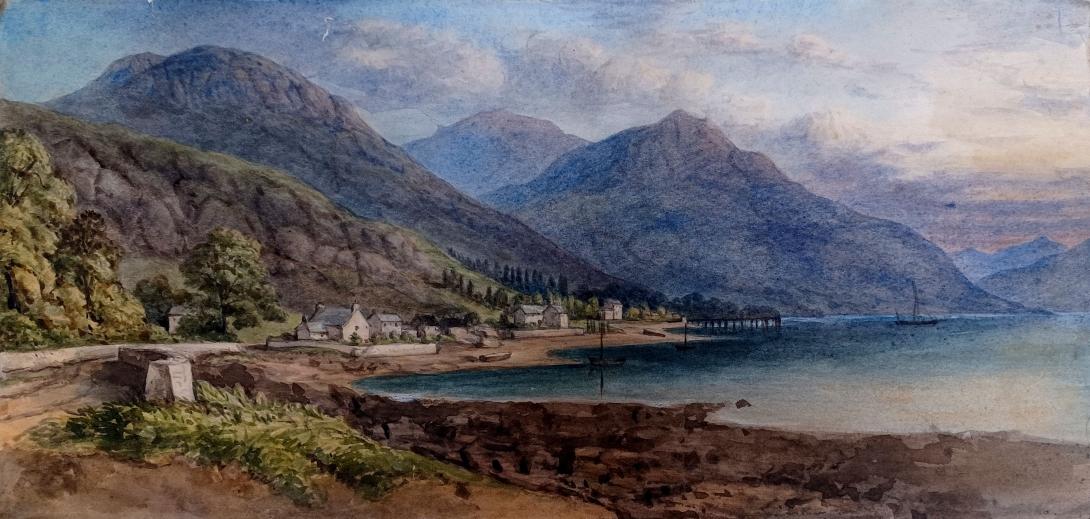
Loch Long is a body of water in the council area of Argyll and Bute, Scotland. The Sea Loch extends from the Firth of Clyde at its southwestern end. It measures approximately 20 miles (30 kilometres) in length, with a width of between one and two miles (two and three kilometres). The loch also has an arm, Loch Goil, on its western side.
Although it is fairly long, its name actually comes from the Gaelic for "ship lake". Prior to their defeat at the Battle of Largs in 1263, Viking raiders sailed up Loch Long to Arrochar, and then dragged their longships 2 miles overland to Tarbet and into Loch Lomond. Being inland, the settlements around Loch Lomond were more vulnerable to attack.
Loch Long forms part of the coast of the Cowal peninsula and forms the entire western coastline of the Rosneath Peninsula.
Loch Long was historically the boundary between Argyll and Dunbartonshire; however, in 1996 boundary redrawing meant that it moved wholly within the council area of Argyll and Bute.
The steamboat Chancellor used to traverse the loch, departing Dunoon at 11:00 and returning about five hours later.was also built to serve Loch Long and Loch Goil from 1947, a route which she still sails today albeit as more of an attraction than a primary means of transport.
Several Scottish sea fishing records are attributed to the loch

The Ardentinny Outdoor Education Centre on the western shore uses the loch for watersports.
It is now a popular area for diving on the numerous wrecks that scatter the loch.
The Finnart Oil Terminal is located on the eastern shore of the loch, linked to the Grangemouth Refinery via a 58-mile-long (93-kilometre) pipeline.

The eastern shore is also the location of the Royal Naval Armaments Depot Coulport, part of His Majesty's Naval Base, Clyde, and the Glen Mallan jetty, linked to Defence Munitions Glen Douglas.
A testing range for torpedoes was established on the loch in 1912, in connection with the Clyde Torpedo Factory in Greenock. It operated through both World Wars, closing in 1986. The loch contains numerous wrecks.
Francis William Staines was the last of a family of merchants from the City of London. Not only was he a successful businessman but he possessed a large independent fortune, such that he could devote his time to the cultivation of his talents in music and art. He was a brilliant amateur violinist, and also loved to spend much of his time painting. His daughter Amelia and her mother accompanied Mr Staines as he travelled throughout the country finding subjects for his painting. One area of the country that they visited frequently was Scotland and the Lake District, and Amelia grew particularly fond of the dramatic landscape of the Fells. Skelwith Bridge with the view of the hills around it 43 was one of her father’s favourite scenes. He painted landscapes and maritime paintings , exhibited 11 works at the RA including views on the Italian Coast, address in London, Hastings and St Leonards on Sea Susssex.