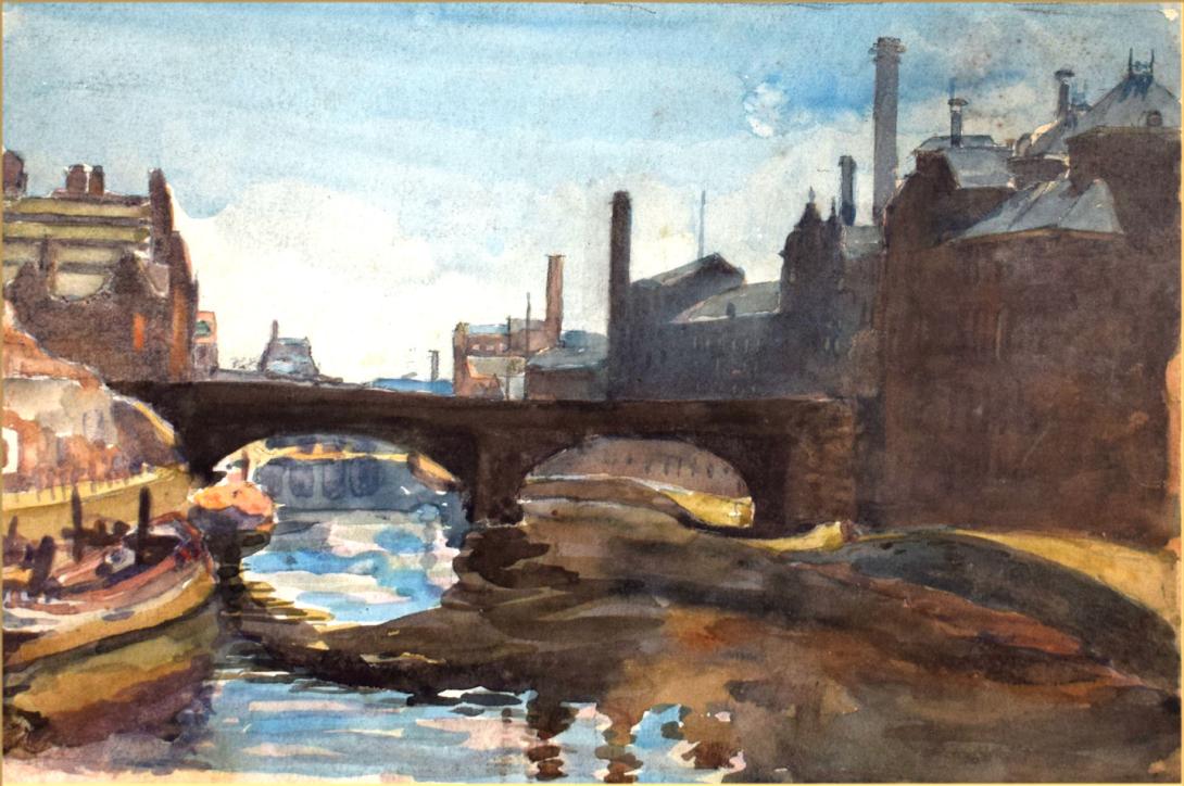
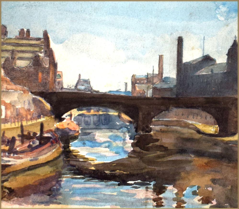

inscribed and dated on the reverse " Regent Rd Bridge /, River Irwell, / June 1929"
Regent-road Bridge connects the township of Hulme with the borough of Salford, and is about 1 mile from the Exchange, opened in 1808, with toll-toll abolished 21st December, 1848; Springfield-lane Bridge connects Salford with Broughton and Bury New-road, constructed 1850. The Bridge is also known as Quaker's hall Bridge. Regent Road Bridge was once a toll bridge built by a Quaker landowner named Hall and he imposed a toll of half a penny to cross, at that time, the bridge became known as Quaker Hall's bridge or the ha'penny bridge, referring to the toll.
Under Regent Road bridge, and on the right we have Hulse’s machine tool works, and then Gresham & Craven, familiar to followers of this thread. Behind here are Calder Street and Ordsal Lane. Another familiar name in this thread is Smith & Coventry. I have only just managed to locate their Gresley Iron Works. It was right behind Gresham & Craven, at the corner of Ordsal Lane and Lower Seddon Street. Regent Road bridge in the middle; below and to the left is a block containing Hulse and Gresham & Craven. Behind these, the street in shadow is Calder Street. This meets Lower Seddon Street which goes more or less left to right. Facing this is the 3 or 4 storey frontage of Smith & Coventry. Not very big, for such a well-known machine tool maker. Behind is a taller building, whose function is not known to me. Looks like a small textile mill. The 1894 map shows the Smith & Coventry building to be to be L-shaped, about 170 ft long, with the longer leg of the L being about 70 ft wide. Cootton Mills and Breweries were located at Regent Road Bridge. A bottling plant of the Groves and Whitnall brewery. Underneath and on the other side of the bridge, also on the left stood the main brewery once one of the most popular breweries in Salford and the surrounding areas.
The River Irwell is a 39-mile (63 km) long river which flows through the Irwell Valley in North West England. Its source is at Irwell Springs on Deerplay Moor, approximately 1.5 miles (2.4 km) north of Bacup. It forms the boundary between Manchester and Salford and empties into the River Mersey near Irlam.
In the 17th and 18th centuries, the Irwell's lower reaches were a trading route that became part of the Mersey and Irwell Navigation. In the 19th century, the river's course downstream of Manchester was permanently altered by the construction of the Manchester Ship Canal which opened in 1896. The canal turned Manchester and Salford into a major inland seaport and led to the development of Trafford Park which became the largest industrial estate in Europe. Further changes were made in the 20th and 21st centuries to prevent flooding in Manchester and Salford, such as the Anaconda Cut in 1970 and the River Irwell Flood Defence Scheme in 2014.
The river became severely polluted by industrial waste in the Industrial Revolution, but in the second half of the 20th century a number of initiatives were implemented to improve water quality, restock it with fish and create a diverse environment for wildlife. Stretches of the river flowing through Manchester and Salford have attracted large-scale investment in business and residential developments, such as Salford Quays, and other parts have become important wildlife havens. The Irwell is used for recreational activities, such as pleasure cruising, rowing, racing and fishing.
From its source to the confluence with the River Mersey the Irwell is about 39 miles (63 km) long. Rising on the moors above Cliviger, it flows south through Bacup, Rawtenstall, Ramsbottom and Bury before merging with the River Roch near Radcliffe. Turning west, it joins the River Croal near Farnworth before turning southeast through Kearsley, Clifton and the Agecroft area of Pendlebury. It then meanders around Lower Kersal and Lower Broughton. It bisects Salford and Manchester, joining the rivers Irk and Medlock, and then turns west toward Irlam, as part of the Manchester Ship Canal. Its course ends just east of Irlam, where it empties into the Mersey.
The origins of the name "Irwell" are uncertain but many accept the Anglo-Saxon origin, ere-well, meaning "hoar or white spring". Flint scrapers, knives and other materials associated with neolithic man were discovered on Kersal Moor in the late 19th century and early 20th century. There have been isolated finds of artefacts characteristic of this period along the Irwell valley, and a possible hunting site was excavated at Prestwich Golf Course in 1982, which produced a quantity of Late Neolithic and Early Bronze Age flints. Neolithic tools have also been found in the River Roch near Bury and in Radcliffe, and Bronze Age burial sites have been found in Bury and Shuttleworth. The first recorded human settlements were those of the Celtic tribe, the Brigantes, who farmed the uplands and lower reaches of the river in the late iron age. In AD 79 the Roman Empire conquered these tribes, building forts at the confluences of the Irwell and the rivers Irk and Medlock and naming the town Mamucium.They also built a ford with rectangular stone blocks at Cornbrook, which is thought to be the first man-made structure to span the river. For four hundred years the Pax Romana brought peace, but their withdrawal in AD 410 left the tribes at the mercy of the Saxons, who renamed the town Manigceastre. The Danes later seized, and all-but destroyed Manigceastre, and absorbed what was left of the tribes. The Danelaw ruled until AD 920 when the Norsemen were expelled by Edward the Elder.
In the Middle Ages the town, which was now known as Manceastre (later to become Manchester), grew and prospered, and trading vessels plied along the river. The hamlet of Kersal, which now forms part of the City of Salford, was gifted to the Cluniac Priory of Lenton, near Nottingham, in 1142. The most important part of the gift was the fishing rights on the River Irwell, and even in the 18th century, the salmon rights on the rivers of Lancashire were let every year for many hundreds of pounds.
During the Industrial Revolution factories, mills and terraced hovels grew up along the river banks. Joseph Corbett, the Borough Engineer of Salford, wrote in his 1907 book The River Irwell of his father Edward's experiences around 1819, of seeing "large shoals of fish, chiefly gudgeon but also other fish, rising to the flies" from a vantage point on New Bailey bridge, (now Albert Bridge) in Manchester. Local industry dumped toxic chemicals into the river, such as gas-tar, gas-lime and ammonia water, and by 1850 fish stocks had all but disappeared. In 1860 the Irwell was described as "almost proverbial for the foulness of its waters; receiving the refuse of cotton factories, coal mines, print works, bleach works, dye works, chemical works, paper works, almost every kind of industry." In 1862 the Scottish geologist Hugh Miller wrote about the Irwell, in his book First Impressions: The English People, describing it as:
The hapless river—a pretty enough stream a few miles higher up, with trees overhanging its banks, and fringes of green sedge set thick along its edges—loses caste as it gets among the mills and the printworks. There are myriads of dirty things given it to wash, and whole waggon-loads of poisons from dye-houses and bleachyards thrown into it to carry away; steam-boilers discharge into it their seething contents, and drains and sewers their fetid impurities; till at length it rolls on—here between tall dingy walls, there under precipices of red sandstone—considerably less a river than a flood of liquid manure, in which all life dies, whether animal or vegetable, and which resembles nothing in nature, except, perhaps, the stream thrown out in eruption by some mud-volcano.
In the Victorian era passenger boat trips were popular but cut-short by the foul smells from the river. In 1862 the Corporation of Salford promoted an Act of Parliament enabling them to establish a River Conservancy Committee; they appointed a river inspector, and had to power to take action against anyone polluting the river.The Rivers Pollution Prevention Act 1876 was designed to solve the problems of river pollution, but it was largely ineffective. It did, however, lay the groundwork for the more draconian legislation which followed, and in 1891 the Mersey and Irwell Joint Committee was formed. Local authorities were ordered to provide sewage treatment facilities, and industrial concerns were told to use the best practical means of preventing pollution. Salford was one of the first authorities in the Irwell watershed to install intercepting sewers and sewage treatment works at Mode Wheel Sewage works.
One of the most famous characters associated with the river during this time was Mark Addy, who was born in a tenement on The Parsonage near Blackfriars Bridge in Manchester in 1838. Whenever anyone was in difficulty in the river, the cry would go up "Bring Mark Addy!" and he would race to the rescue. He was awarded a number of medals including the gold and silver medals from the Humane Society for the Hundred of Salford, and the Royal Humane Society's bronze medal. In 1878 he became the only civilian ever to be awarded the Albert Medal (first class), His final rescue was on Whit Monday in 1889, when he saved a young boy from a particularly sewage-laden section of the river. After this he became ill, and died of tuberculosis in 1890 aged 51. He had rescued over 50 people from the river during his lifetime.
The Industrial Revolution saw the river badly polluted by industry, as pictured in this photograph of Radcliffe taken in 1902.
In 1939, the Mersey and Irwell Joint Committee was superseded by the Lancashire Rivers Board, but wartime conditions brought about further deterioration of the river. In 1951, the Rivers (Prevention of Pollution) Act was passed and this board disappeared to be replaced by the Mersey River Board, which was replaced in turn by the Mersey and Weaver River Authority in 1965. During a 1950s television documentary entitled River of Irwell, the watercourse was described as "The hardest worked river in the world".
In 1946, there was serious flooding in Salford, caused by a bottleneck at a bend in the river at Strangeways, on the border with Manchester. Flooding had been a problem for hundreds of years, and, in 1946, the decision was made to straighten and widen the river to increase its capacity. Work started in 1951 but it was not until September 1970 that water first flowed through the Anaconda Cut. The total cost of the project was £2m.
In a question to the House of Commons in 1950 the Member of Parliament for Rossendale, Mr. Anthony Greenwood, highlighted the lamentable condition of the Irwell and one of its main tributaries, the River Roch:
Today I am afraid that fish in most of those rivers are virtually extinct. Anybody who stands today in the City of Manchester outside the Exchange Station and looks down at the noisome black water which flows beneath him would find it difficult to believe that any fish, or any other living creature, could ever have lived in what the Manchester Guardian has so rightly called that "melancholy stream"... I have had my differences with the British Field Sports Society, but I have nothing but admiration for the excellent series of reports on river pollution which have been prepared for that Society... and ventured to suggest that they should make a similar survey of the Rivers Irwell and Roach. These two rivers were covered by the third report; and very sorry reading it made. There are two passages in that report which I should like to read. The first says: "The banks are lined with factories, large and small, many of which take their water from the drainage of the hills forming the slopes of the river's valley, and discharge it as a polluted effluent, either into the small feeders, or the main river itself, so it may be said that no natural water normally enters the river from its cradle in the moors to its grave in the Manchester Ship Canal." The second quotation is one which I find still more appalling than the first. It is: "There are no fish in these rivers (apart from a very occasional tributary), no insects, no weeds, no life of any kind except sewage fungus, nothing but chemicals and any dirt which cannot be put to profitable use. Sewage effluents (and, being usually very good, they are the most encouraging feature of the appalling situation) are hailed with delight as being the purest water which the rivers hold." The full importance of that statement will be realised when I remind hon. Members of the frequency with which residents in Bacup, Ramsbottom, Manchester and Salford are subjected to flooding from the waters of the Irwell.
In 1951, it was announced that flood defence works were to be carried out on the stretch of the river passing through Lower Broughton between Cromwell Bridge and Gerald Road Bridge, although local property owners and shopkeepers were outraged at being asked to bear part of the cost. Work on the 8-foot-thick (2.4 m) concrete wall did not get underway until June 1952 and was still only nearing completion when, in August 1957, nearby homes were threatened by flooding during heavy rain.
Iron oxide pollution near the river's source. A report in the Manchester Evening News in 1971 stated that Bury Angling Society had signed an agreement with Bury Corporation giving them fishing rights along four miles (6.4 km) of the river between Summerseat and Radcliffe. The secretary of the society was quoted as saying:
Extensive tests have been carried out on fish we put in the river and we are satisfied that the water will support fish life. Roach and perch have already been caught and we have had no reports of any ill-effects. There is no doubt the pollution is clearing. It will be a long job, but we are sure there is a future for angling in the river.
The report went on to state that the society "intends to carry out stocking operations soon". In 1972 the newspaper reported that "tiddlers" (small fish) had been seen swimming in the "notorious inky Irwell" near Peel Park, Salford. The Deputy chief water quality officer for Salford, Mr. Eric Harper, said:
Ten years ago, any fish getting as far down as Salford would have been killed almost immediately by the pollution in the water. Although the river there is now a great deal better than it has been for 100 years, fish will probably not be able to live long. These had probably got into the main river from small streams flowing into the Irwell. But I think it is real progress.
Mr Harper went on to say that the Irwell had been well stocked with fish along its whole length 100 years ago but refused to guess when it would reach the same state again. In 1974 all of the river authorities were merged into the Regional Water Authorities. In the 1974 annual report of the North West Water Authority (NWWA), it was said that the river "once internationally famous, or infamous as the epitome of river pollution, is now in a much better state as compared with its condition at the time of a special survey carried out nine years ago." This was reported in an article in The Manchester Evening News on 26 October of that year which stated that:
During nine years of pollution control work reviewed by the North West Water Authority, the biggest improvement had been in the Bolton District, where effluent from five dilapidated sewage plants and two paper mills were now being treated at the Ringley Fold Works [but] there has been little reduction in pollution from the river Roch. At Bacup the headwater of the Irwell is discoloured by ochre deposits from a disused mine but work is being done to stop the ochre seepage. Fish do exist in the stretch between Rossendale and Bury and fish are to be introduced in stretches between Radcliffe and Manchester. However, it is feared that it will be many years before fish will be able to breed freely in the river.
In 1980, a scheme for improving a section of the river between Littleton Road and Adelphi Weir in Salford for boating purposes was included in Greater Manchester Policy Committee's capital programme for 1981/82. County Councillors at a recent committee meeting had criticised the condition of the river, with the councillor for the Metropolitan Borough of Oldham calling it "quite revolting and horrible". A spokesperson for the NWWA said that, although the river had a reputation for being polluted, it was getting much better but still had not reached a state where they would be satisfied. She added that tests were being carried out to show the improved cleanliness of the Irwell and that 600 trout had recently been put in the river at Summerseat, near Bury. The proposals were welcomed by both Salford University and Agecroft Rowing Club, with the university stating that they wished to use that section for their boat race. Later that year it was reported that hundreds of trees and shrubs were to be planted along the banks of the Irwell between Broughton and Pomona Dock in a £650,000 "green finger" scheme to "bring the countryside into the heart of industrial Salford".The dossier outlining the scheme, prepared by Salford's Technical Services Officer, emphasised the "bleak character" of the Irwell Valley with "many constructions by the river that are decaying and rotting" and said "the main problems are caused by an excess of ammonia and a high organic content from sewage effluents which discharge into the water upstream." The report recommended that "even more support should be given to the NWWA in their pollution control of the River Irwell."
Throughout the 1980s, sightings of fish as far downstream as Manchester city centre were reported in local newspapers. In February 1981 the Manchester Evening News reported that "ten jacksharps [sticklebacks], about two inches long" had been spotted by a site manager working on the Mark Addy public house, which was then being built on the disused New Bailey Landing Stage, below New Bailey Street, on the border of Manchester and Salford. Plans for developing the river for recreational use were also coming to fruition as it was reported in 1982 that, over the May bank holiday, the first pleasure cruise on the river in the 20th century would leave from the Mark Addy as part of a three-day experiment to see whether river cruises could be a success. In 1983 over 100 canal and river boats rode the flooded river for the Greater Manchester Waterways Festival, an event aimed at demonstrating how pleasure boating could "transform the bleak waterway in the heart of Manchester". By 1984 two local men felt the waters were clean enough for them to brave a ten-mile (16 km) charity fund-raising swim from Clifton to Manchester, although they were warned by a spokesman for the North West Water Authority that the cocktail of effluent and occasional untreated sewage meant that the Irwell was still "a class 4 river – top of the pollution chart". During 1985 the Croal–Irwell Valley local plan was launched, listing 187 proposals for the improvement of the valley and in 1986 the Mersey Basin Campaign was announced. The campaign was to cover a large area, from Rossendale in the north to Crewe in the south, and it was promised that £67m would be made available in the first three years for water- and land-based projects. In September 1987 plans were revealed for a mile-long landscaped walkway in Manchester city centre and developers announced plans to develop three bricked-up railway arches on the side of the river, opposite Manchester Cathedral, into a wine bar and restaurant. In 1988 Manchester's first water bus made its maiden voyage from the New Bailey Landing Stage, then known as the Mark Addy Quay, on a five-mile (8 km) inaugural round trip to Salford Quays[56] By the end of the 1980s ambitious plans had been announced to turn Manchester into a top international tourist centre "mainly based on the derelict areas around the waterways of Manchester, Salford and Trafford – the Irwell, the Irk, the ship canal and the Bridgewater Canal...bringing £500m of investment and 13,000 new jobs over the next 10 years". The Manchester Ship Canal Company also announced a £70 million redevelopment scheme for Pomona Docks in Salford, to include a marina, homes, offices and other commercial developments.
In 1990, the newly formed Mersey and Irwell Packet Company launched regular tourist trips along the river from a landing stage opposite the Granada Studios Tour entrance in Quay Street, taking in the stretch from Castlefield to Salford Quays.[58] This was not universally welcomed as, by September of that year, a retired chemical engineer claimed that the pleasure boat was "leaving clouds of methane in its wake as it disturbed sediment on the river bed". However, in 1991 a feature article appeared in the magazine Lancashire Life extolling the virtues of the cruise, and stating that the Irwell "once thought a liability is in fact a major asset to urban regeneration ... now the twin cities compete to befriend her, to dress her in finery and proudly introduce her back into society. And the public are cordially invited back onto her waters." During 1994, construction work began on a new £1.3M footbridge to link Manchester and Salford, to be known as Trinity Bridge. The box-girder and steel cable construction was designed by Spanish architect Santiago Calatrava to represent a ship in full sail[61] as the centrepiece of the £50M Chapel Wharf Regeneration Scheme, which was expected to breathe new life into a run-down area of Salford and to create up to 8,000 new jobs. In May 1995 a new 30-mile (48 km) long multimillion-pound arts trail, to be known as the Irwell Sculpture Trail, was reported in the Manchester Evening News and in June 1997 work began on the £10 million Lower Irwell Valley Flood Defence Scheme in Lower Kersal.
In July 2000 there was a setback for the clean-up programme when a pollution incident affected approximately 2.5 miles (4.0 km) of the river between Rawtenstall and Ramsbottom, causing the death of more than 36,000 fish. The large number of fish killed, however, did serve to illustrate how much the river had improved from the lifeless, "melancholy stream" of the 1950s. In 2005 a £1M project to make the river "the cleanest it has been for decades" was announced by United Utilities. The improvements included fitting filters on sewers in Lower Broughton to ensure litter was not washed into the river, as part of a scheme to improve overflows across Adlington, Wigan, Chorley, Rochdale and Bury. Then in October 2008 United Utilities announced that work on the Ringley Fold Wastewater Works in Stoneclough, to be completed by the end of the year, should increase the number of fish in the river and "massively improve the environment locally so walkers, canoeists and anglers will all reap the benefits." The company said that this was to be the biggest scheme that they had undertaken in the region, and the project manager was quoted as saying:
"Reducing the amount of phosphate in the water is the main driver behind the scheme. New legislation states that the amount of phosphate in waste water should be one milligram per litre because it causes water to clog with algae and reduces the amount of oxygen in the water, which results in less aquatic life and fish."
The treatment plant, which was built in the 1930s and last updated in the 1970s, treats waste water from a population of half a million, from Bolton, Prestwich, Whitefield and Clifton.
There was another pollution incident in March 2008 when twenty miles of the river turned orange. Iron oxide from old mine workings near the source at Irwell Springs had polluted the water since 1969 and in 1997 a Coal Authority survey identified the stretch as having the fourth worst case of minewater pollution in the country. A treatment plant was built in 1999 to remove the pollution at a cost of £1M; however, it is thought that there was a collapse in the mine after heavy rains in the spring of 2008. Although the water was stained with ochre, no damage to wildlife was reported.
A large urban regeneration project, The Salford Quays Development Plan, was published in 1985 and work began a few years later to redevelop the site for residential, business and leisure purposes. The Salford Quays waterside development has made living by the Irwell, and the Manchester Ship Canal into which it flows, fashionable once again.
There are further plans to "turn the tide on the years of neglect and once again embrace the River Irwell as a fundamental part of Manchester and Salford's heritage and future economic and social growth. The vision is to reinvent the central Manchester conurbation as the major waterfront destination in Northern England." A number of key stakeholders are involved in the development of this regeneration vision. These include Manchester, Salford and Trafford councils, Manchester Ship Canal Company, Environment Agency, Mersey Basin Campaign, local businesses, landowners, community groups and the wider Manchester, Salford and Trafford communities.
Albert Vincent Reade was born in 1864, he was a portrait, landscape and still life painter. He studied at the Manchester Academy of Fine Arts and Colarossi's Paris, He exhibited between 1901 and 1933 and lived in Manchester.