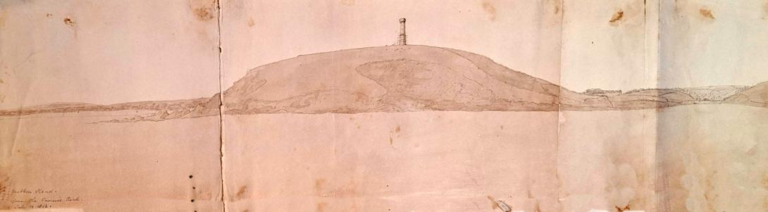
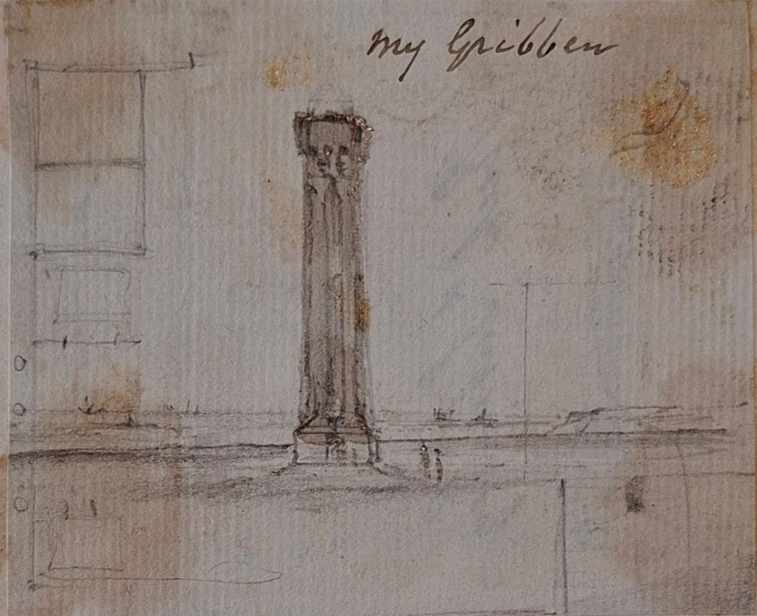
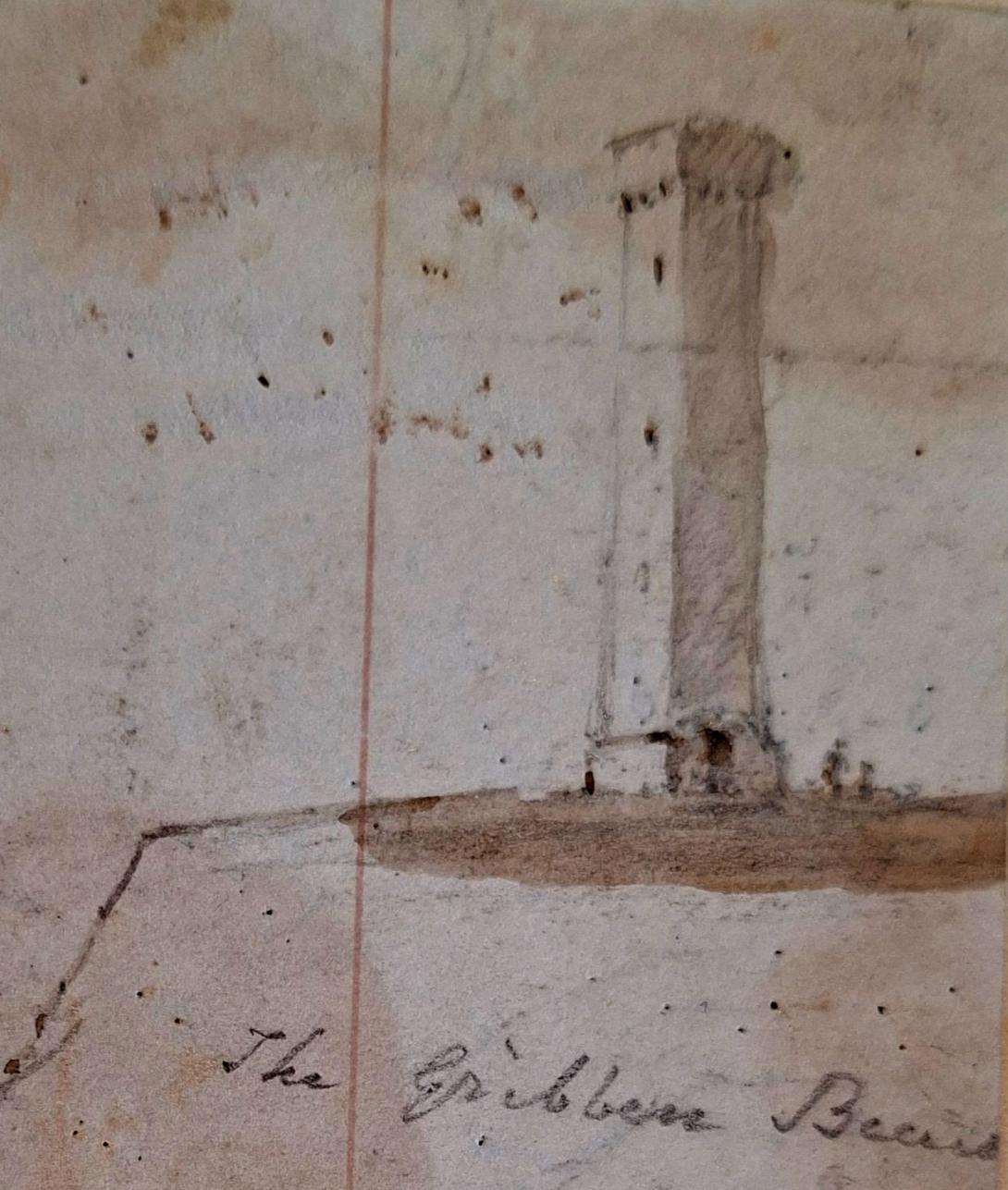
Gribben Head from the Cannis Rock July 10 1832 and The Gribben built and my Gribben
Gribbin Head is a promontory on the south coast of Cornwall, England, UK, owned and managed by the National Trust. It separates St Austell Bay from the estuary of the River Fowey and is marked by a large tower used to aid navigation of ships approaching the local harbours. The nearest town is Fowey. The western point of the headland is called Little Gribbin.
Gribbin Head is the most southerly part of the parish of Fowey. To the north, and facing west across St Austell Bay is the small village of Polkerris, beyond which is the harbour at Par. To the east is Polridmouth cove and the Fowey estuary, where the town of Fowey itself is situated. Inland, to the north, is the Menabilly estate, built for the Rashleigh family but later home to author Daphne du Maurier.
The 75 metres (246 ft) high promontory forms a part of the South Coast (eastern) section of the Cornwall Area of Outstanding Natural Beauty. The South West Coast Path passes around Gribbin Head on its way from Minehead in Somerset to Poole in Dorset.
Gribbin Tower

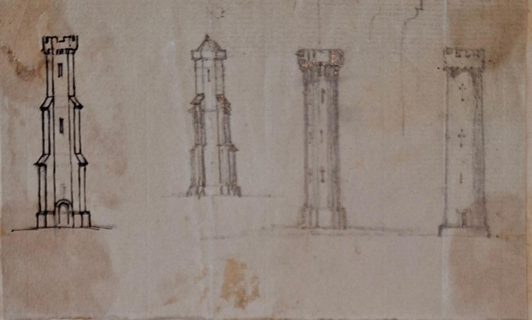
The 84 feet (26 m) high square beacon tower was erected by Trinity House in 1832 to distinguish the Gribben from Dodman Point and St Anthony’s Head, and thus make navigation into Fowey and the harbours of St Austell Bay safer. It was never lighted, but is painted in broad red and white bands as a daymark. It has been a Grade II Listed Building since 1974.
The tower featured in the first episode of the BBC TV series The Coroner
1.25 miles southwest of the entrance to Fowey Harbour and located within the Par Sand to Looe Area of Outstanding Natural Beauty is Gribbin Head (sometimes spelt Gribben Head and named after the Cornish for 'little ridge'), a spectacular promontory whose sheer cliffs rise 250 feet above sea level and which provides stunning views of the English Channel and the coastal landscape to the east and west. The land has been owned by the National Trust since 1957 and is managed as part of Britain's Heritage Coast.
From the sea, the headland looks similar to others on the south west coast and in bad weather mariners were known to mistake it for St Anthony's Head near Falmouth, with potentially fatal consequences. One near-miss by the schooner Poulteray was reported in the Royal Cornwall Gazette on 11 December 1830, the same month in which three ships were wrecked at nearby Dodman Point. Two years later, at the request of the Borough of Fowey, Trinity House erected a conspicuous tower to serve as a daymark, enabling ships to distinguish the headland from others in the area. Although damaged in a thunderstorm in 1837, the red and white painted Greco-Gothic style tower still stands 84 feet high and a total of 330 feet above mean high water. It is occasionally opened to the public.
The Gribbin daymark is not only easy to spot, it is also easily accessible to the public as it lies on the South West Coast Path, approached from the east by a short steep incline from Polridmouth Bay and from the west by a path which follows the coast from the hamlet of Polkerris.
Gribbin Head Daymark is located on a headland to the west of the Fowey estuary on the southern coast of Cornwall.
The headland separates the River Fowey from St Austell Bay. The daymark was built to distinguish the headland from Dodman Point and St Anthony’s Head in Falmouth. The beacon aids navigation into Fowey and St Austell Bay.
The square tower has never been lit. It is 26 metres tall and was built in 1832 by Trinity House ‘for the safety of commerce and the preservation of mariners’.
Gribbin Head Daymark has 109 steps and has red and white bands painted to make it a prominent daymark.
Landowner William Rashleigh of Menabilly leased the land to Trinity House. He hoped the beacon would be an “ornament to my grounds”. The Menabilly estate was built for the Rashleigh family. Later Menabilly became home to author Daphne du Maurier who leased the house from the Rashleigh family.
Gribbin Headland was acquired by the National Trust in 1967. In 1998 the daymark was acquired with funding from the Fowey River and Coast Appeal and a bequest from Miss H Miller.
Richard Suter was born in Greenwich, Kent on 30th March 1798, to William Suter and his wife Sarah Knights. On 7th January 1825 he married Anne Ruth Burn.
English architect. As Surveyor to The Fishmongers' Company he designed the severe Presbyterian churches for Ballykelly (1825–7) and Banagher (1825) on the Company's Estate in County Londonderry, drawings of which were exhibited at the Royal Academy in 1827. He was also responsible for the Model Farm (1823–4), the Lancasterian Schools (1828–30), the Company Agent's House (1830–2—now a hotel, much altered), a range of houses on the south side of the main road (1823–4), the lodge in the Presbyterian churchyard (1828), and the Dispensary (1829), all at Ballykelly, and all Classical. As Surveyor to Trinity House Corporation, he designed houses that were erected by Thomas Cubitt in 1821–3 on a site adjoining Trinity House. For The Fishmongers' Company he designed St Peter's Almshouses, Wandsworth, London (1849–51), and The Old School-House, Gresham's School, Holt, Norfolk(1859), in an Elizabethan style.
On the 1841 Census Richard, an architect and lawyer, can be found living in London with his wife Ann (listed as Ruth) and their two children, Richard George and Andrew Burn. Living with them is Edward D Suter. 1851 finds the family living in Tottenham Court in London, by this time Andrew had left the home, but I am unable to trace him on the 1851 Census. In 1860 Andrew marries Amelia Damaris Harrison. Both Richard George and Andrew were to become ordained ministers, with Andrew later becoming a Bishop and emigrating to New Zealand. Sadly in 1854 Anne Ruth was to pass away. In 1861, widowed Richard, Justice of the Peace for Maidenhead, is living at Castle Hill, Maidenhead, Berkshire. In 1862 he married Elizabeth Anne Pocock. In 1871 and 1881 Richard and Elizabeth are still living in Castle Hill. Richard was to pass away on 1st March1883.
Richard Suter & Annesley Voysey, architects, had their office at number 35 Fenchurch Street, but they did not have it all to themselves as they shared the premises with W.C. Franks, a tea broker, who will get a separate post some other time. The earliest mention I found of Richard Suter in Fenchurch Street is in 1832 when he is listed at that address in a list of contributing members of the Society for the Propagation of the Gospel in Foreign Parts. It says that he had been a member since 1829, but that does not mean he was already at 35 Fenchurch Street in that year.(1) In fact, that seems unlikely as the Sun Fire Office records give Messrs. Short and Co., merchants, as paying the insurance premium on the premises in May 1830. The Directory of British Architects 1834-1914 give the year 1827, but I do not know on what evidence. When Suter and Voysey became partners is also uncertain, but they had known each other since at least 1825 as Suter is named as one of the executors of Voysey’s will which was dated 22 July, 1825. The address given for Suter in the will is Suffolk Street, Southwark. Voysey then lives at Conway Street, Fitzroy Square.