" P Yates" and inscribe don the reverse
Unframed
Mont Blanc is the highest mountain in the Alps and Western Europe, rising 4,807.81 m (15,774 ft) above sea level. It is the second-most prominent mountain in Europe, after Mount Elbrus, and it is the eleventh most prominent mountain summit in the world.
It gives its name to the Mont Blanc massif which straddles parts of France, Italy and Switzerland. Mont Blanc's summit lies on the watershed line between the valleys of Ferret and Veny in Italy, and the valleys of Montjoie, and Arve in France. Ownership of the summit area has long been a subject of dispute between France and Italy.
The Mont Blanc massif is popular for outdoor activities like hiking, climbing, trail running and winter sports like skiing, and snowboarding. The most popular climbing route to the summit of Mont Blanc is the Goûter Route, which typically takes two days.
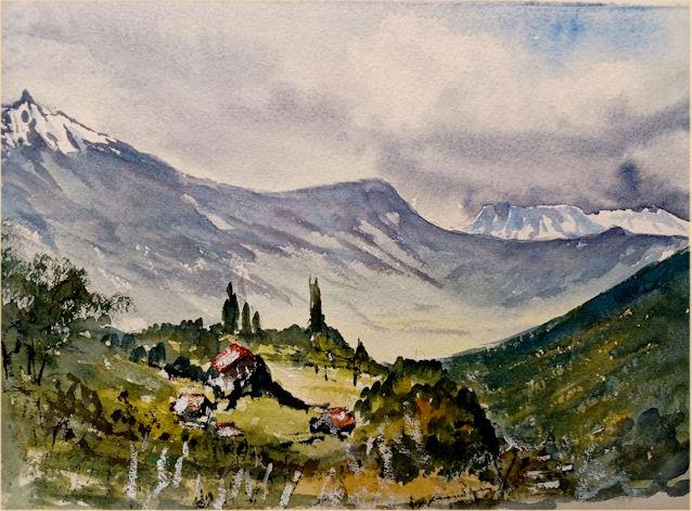
The three towns and their communes which surround Mont Blanc are Courmayeur in Aosta Valley, Italy; and Saint-Gervais-les-Bains and Chamonix in Haute-Savoie, France. The latter town was the site of the first Winter Olympics. A cable car ascends and crosses the mountain range from Courmayeur to Chamonix, through the Col du Géant. The 11.6 km (7+1⁄4-mile) Mont Blanc Tunnel, constructed between 1957 and 1965, runs beneath the mountain and is a major transalpine transport route.
Since 1760 Swiss naturalist Horace-Bénédict de Saussure began to go to Chamonix to observe Mont Blanc. He tried with the Courmayeur mountain guide Jean-Laurent Jordaney, a native of Pré-Saint-Didier, who accompanied De Saussure since 1774 on the Miage Glacier and on Mont Crammont.
The first recorded ascent of Mont Blanc (at the time neither within Italy nor France) was on 8 August 1786 by Jacques Balmat and the doctor Michel Paccard. This climb, initiated by Horace-Bénédict de Saussure, who gave a reward for the successful ascent, traditionally marks the start of modern mountaineering. The first woman to reach the summit was Marie Paradis in 1808.
At the scale of the Mont Blanc massif, the border between Italy and France passes along most of the main Alpine watershed, from the Aiguille des Glaciers to Mont Dolent, where it reaches the border with Switzerland. However, its precise location near the summits of Mont Blanc and nearby Dôme du Goûter has been disputed since the 18th century. Italian officials claim the border follows the watershed, splitting both summits between Italy and France, while French officials claim the border avoids the two summits, placing both of them entirely with France. The size of these two (distinct) disputed areas is approximately 65 ha on Mont Blanc and 10 ha on Dôme du Goûter.
Since the French Revolution, the issue of the ownership of the summit has been debated. From 1416 to 1792, the entire mountain was within the Duchy of Savoy.[citation needed] In 1723, the Duke of Savoy, Victor Amadeus II, acquired the Kingdom of Sardinia. The resulting state of Sardinia was to become preeminent in the Italian unification. In September 1792, the French Revolutionary Army of the Alps under Anne-Pierre de Montesquiou-Fézensac seized Savoy without much resistance and created a department of the Mont Blanc. In a treaty of 15 May 1796, Victor Amadeus III of Sardinia was forced to cede Savoy and Nice to France. In article 4 of this treaty, it says: "The border between the Sardinian kingdom and the departments of the French Republic will be established on a line determined by the most advanced points on the Piedmont side, of the summits, peaks of mountains and other locations subsequently mentioned, as well as the intermediary peaks, knowing: starting from the point where the borders of Faucigny, the Duchy of Aoust and the Valais, to the extremity of the glaciers or Monts-Maudits: first the peaks or plateaus of the Alps, to the rising edge of the Col-Mayor". This act further states that the border should be visible from the town of Chamonix and Courmayeur. However, neither is the peak of the Mont Blanc visible from Courmayeur nor is the peak of the Mont Blanc de Courmayeur visible from Chamonix because part of the mountains lower down obscure them.
After the Napoleonic Wars, the Congress of Vienna restored the King of Sardinia in Savoy, Nice, and Piedmont, his traditional territories, overruling the 1796 Treaty of Paris. Forty-five years later, after the Second Italian War of Independence, it was replaced by a new legal act. This act was signed in Turin on 24 March 1860 by Napoleon III and Victor Emmanuel II of Savoy, and deals with the annexation of Savoy (following the French neutrality for the plebiscites held in Tuscany, Modena, Parma and Romagna to join the Kingdom of Sardinia, against the Pope's will). A demarcation agreement, signed on 7 March 1861, defined the new border. With the formation of Italy, for the first time Mont Blanc was located on the border of France and Italy, along the old border on the watershed between the department of Savoy and that of Piedmont formerly belonging to the Kingdom of Savoy.
The 1860 act and attached maps are still legally valid for both the French and Italian governments. In the second half of the nineteenth century, on surveys carried out by a cartographer of the French army, Captain JJ Mieulet, a topographic map was published in France, which incorporated the summit into French territory, making the state border deviate from the watershed line, and giving rise to the differences with the maps published in Italy in the same period.
NATO maps take data from the Italian national mapping agency, the Istituto Geografico Militare, which is based upon past treaties in force.
Modern Swiss mapping, published by the Federal Office of Topography, plots a region of disputed territory (statut de territoire contesté) around the summits of both Mont Blanc and the Dôme du Goûter. One of its interpretations of the French-Italian border places both summits straddling a line running directly along the geographic ridgeline (watershed) between France and Italy, thus sharing their summits equally between both states. However, a second interpretation places both summits, as well as that of Mont Blanc de Courmayeur (although much less clearly in the latter case), solely within France. As of 2021, the border dispute between the two countries is ongoing.
The summit of Mont Blanc is a thick, perennial ice-and-snow dome whose thickness varies. No exact and permanent summit elevation can therefore be determined, though accurate measurements have been made on specific dates. For a long time, its official elevation was 4,807 m (15,771 ft). In 2002, the IGN and expert surveyors, with the aid of GPS technology, measured it to be 4,807.40 m (15,772 ft 4 in).
After the 2003 heatwave in Europe, a team of scientists remeasured the height on 6 and 7 September. The team was made up of the glaciologist Luc Moreau, two surveyors from the GPS Company, three people from the IGN, seven expert surveyors, four mountain guides from Chamonix and Saint-Gervais and four students from various institutes in France. This team noted that the elevation was 4,808.45 m (15,775 ft 9 in), and the peak was 75 cm (30 in) away from where it had been in 2002.
After these results were published, more than 500 points were measured to assess the effects of climate change and the fluctuations in the height of the mountain at different points. Since then, the elevation of the mountain has been measured every two years.
The summit was measured again in 2005, and the results were published on 16 December 2005. The height was found to be 4,808.75 m (15,776 ft 9 in), 30 cm (12 in) more than the previous recorded height. The rock summit was found to be at 4,792 m (15,722 ft), some 40 m (130 ft) west of the ice-covered summit.
In 2007, the summit was measured at 4,807.9 m (15,774 ft) and in 2009 at 4,807.45 m (15,772 ft). In 2013, the summit was measured at 4,810.02 m (15,781 ft) and in 2015 at 4,808.73 m (15,777 ft).From the summit of Mont Blanc on a clear day, the Jura, the Vosges, the Black Forest and the Massif Central mountain ranges can be seen, as well as the principal summits of the Alps.