a page from an album inscribed in the frontispage "F W Staines 3 Uplands St Leonards on Sea"
Amelia Jackson, Nee Staines (1842 – 1925) and thence by descent
Brodick Tràigh a' Chaisteil ("Castle Beach") or Breadhaig) is the main village on the Isle of Arran, in the Firth of Clyde, Scotland. It is halfway along the east coast of the island, in Brodick Bay below Goat Fell, the tallest mountain on Arran. The name is derived from the Norse "breda-vick" meaning "Broad Bay".
The harbour receives the main ferry between Arran and the mainland via Ardrossan. Brodick Castle is a former residence of the Dukes of Hamilton.
Brodick is one of the largest villages on the island and is seen as the main hub due to the ferry terminal which connects the island to the mainland. It is host to many homes, hotels and shops, the health centre, nursing home, heritage museum, tourist information centre, Brodick Castle, public beach, park and an 18-hole golf course.
Brodick has Arran's main ferry terminus, which occasionally connects Brodick to Ardrossan on the mainland and to the national rail network. The ferries are operated by Caledonian MacBrayne. MV Caledonian Isles serves the island year-round, with MV Isle of Arran providing additional sailings during the summer. The crossing takes less than one hour. The route is one of the busiest crossings on the CalMac network, and dolphins and basking sharks are rarely spotted en route. A second, smaller ferry – MV Catriona – sails from Lochranza to Claonaig on the Kintyre peninsula between March and October.
The village has seen investment recently with £30M being spent on the new Brodick Ferry Terminal. This is a new larger passenger terminal with a larger pier capable of handling two large vessels at once, increasing capacity on Scotland's busiest ferry route which handled 828,262 passengers and 202,843 cars in 2016 up 8.7% and 6.8% respectively.
In addition to the new ferry terminal, which was formally opened by Derek Mackay MSP on 12 April 2018, the island is expected to get a new dual-fuelled ferry built on the River Clyde for around £45m. The ferry has been named MV Glen Sannox after a public vote in Spring 2017, and the ferry was expected to be delivered in early 2019. Unfortunately this deadline has been delayed, and it is unknown when it will enter service.
The village is connected to all parts of the island by road including Lamlash and Whiting Bay to the south, Lochranza to the north and Blackwaterfoot to the west.
A new upgraded bus terminal opened in Brodick at the new ferry terminal in early 2017, and is a hub for transport on the island, providing many bus services.
Brodick is a popular holiday destination and a base for hill-walking. Tourism provides much of the village's economic base. There are many family-owned and independent businesses, such as hotels, restaurants, shops, bed and breakfast establishments, guest houses and outdoor activities. There is also a brewery (located in nearby Cladach), a sports and leisure complex, and an 18-hole golf course.
The village of Brodick is the largest settlement on the island (although Lamlash has a larger population), and is seen as the centre of economic activity due to the many businesses that are located around the village. These include the 22 bedroom Douglas Hotel & Bar, and the Auchrannie Spa and Resort, which comprises two 4-star hotels with 85 rooms and thirty 5-star self-catering lodges along with a spa, two leisure centres, and adventure company and more on site. The village is also the home of Arran Haulage and Arran Aromatics, as well as many more small independent businesses.
Brodick has a primary school, village hall, library, church, sports park, health centre and public beach, and is the main shopping base on the island. Brodick has a large Co-op supermarket in the village, as well as a smaller Co-op convenience store at Invercloy. There are also hairdressers, estate agents, the post office, gift shops, bakers, chocolate shop, bike hire store, and numerous cafes, bars and restaurants, most notably Crofters, Douglas Bistro, Ormidale Bar, Brodick Bar and The Auchrannie Resort which has three restaurants and bars; Brambles - Seafood & Grill, Cruize - Bar/Brasserie and Eighteen69 - Scottish Tapas. Brodick is also home to Brodick Golf Club, which has 18 holes.
The high school, council offices, Highlands and Islands University Resource Centre and hospital can all be found in Lamlash, located 3 miles (5 kilometres) to the south.
The largest peak on the island, Goat Fell, overlooks the village and Brodick Bay. Reaching 874 metres (2,867 ft) above sea-level, it is one of the most popular hiking routes in Scotland.
-
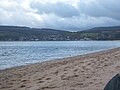
Brodick from Cladach Beach
-

Brodick Castle Gardens
-

Brodick new ferry terminal under construction 2016
-
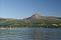
Goatfell from Brodick Harbour


Brodick Castle was previously a seat of the Dukes of Hamilton, but is now owned by the National Trust for Scotland. The castle itself will be closed for 2 years until 2018/2019 for refurbishment by NTS, however the grounds will be open throughout. A new Kids adventure section of the park opened in July 2017.
The Isle of Arran or simply Arran is an island off the west coast of Scotland. It is the largest island in the Firth of Clyde and the seventh-largest Scottish island, at 432 square kilometres (167 sq mi). Historically part of Buteshire, it is in the unitary council area of North Ayrshire. In the 2011 census it had a resident population of 4,629. Though culturally and physically similar to the Hebrides, it is separated from them by the Kintyre peninsula. Often referred to as "Scotland in Miniature", the island is divided into highland and lowland areas by the Highland Boundary Fault and has been described as a "geologist's paradise".
Arran has been continuously inhabited since the early Neolithic period. Numerous prehistoric remains have been found. From the 6th century onwards, Goidelic-speaking peoples from Ireland colonised it and it became a centre of religious activity. In the troubled Viking Age, Arran became the property of the Norwegian crown, until formally absorbed by the kingdom of Scotland in the 13th century. The 19th-century "clearances" led to significant depopulation and the end of the Gaelic language and way of life. The economy and population have recovered in recent years, the main industry being tourism. However, the increase in tourism and people buying holiday homes on the Island, the second highest rate of such homes in the UK, has led to a shortage of affordable homes on the island. There is a diversity of wildlife, including three species of tree endemic to the area.
The island includes miles of coastal pathways, numerous hills and mountains, forested areas, rivers, small lochs and beaches. Its main beaches are at Brodick, Whiting Bay, Kildonan, Sannox and Blackwaterfoot.
Most of the islands of Scotland have been occupied consecutively by speakers of at least four languages since the Iron Age. Therefore, the names of many islands have more than one possible origin, including Arran. Mac an Tàilleir (2003) says the name "is said to be unrelated" to those of Arranmore or the Aran Islands in Ireland, which come from Irish Árainn meaning "kidney-shaped", though he does not rule out this derivation.
Unusually for a Scottish island, Haswell-Smith (2004) and William Cook Mackenzie (1931) offer a Brythonic derivation and a meaning of "high place" (c.f. Middle Welsh aran) which at least corresponds with the geography – Arran is significantly loftier than all the land that immediately surrounds it along the shores of the Firth of Clyde.
Any other Brythonic place-names that may have existed, save perhaps for Mayish, were later replaced on Arran as the Goidelic-speaking Gaels spread from Ireland, via their adjacent kingdom of Dál Riata.
During the Viking Age it became, along with most Scottish islands, the property of the Norwegian crown, at which time it may have been known as "Herrey" or "Hersey". As a result of this Norse influence, many current place-names on Arran are of Viking origin.

The island lies in the Firth of Clyde between Ayr and Ardrossan, and Kintyre. The profile of the north Arran hills as seen from the Ayrshire coast is referred to as the "Sleeping Warrior", due to its resemblance to a resting human figure.The highest of these hills is Goat Fell at 873.5 metres (2,866 ft).[16] There are three other Corbetts, all in the north east: Caisteal Abhail, Cìr Mhòr and Beinn Tarsuinn. Beinn Bharrain is the highest peak in the north west at 721 metres (2,365 ft).
The largest glen on the island is Glen Iorsa to the west, whilst narrow Glen Sannox to the east surround Goat Fell. The terrain to the south is less mountainous, although a considerable portion of the interior lies above 350 metres (1,150 ft), and A' Chruach reaches 512 metres (1,680 ft) at its summit. There are two other Marilyns in the south, Tighvein and Mullach Mòr (Holy Island).
See also: Category:Villages in the Isle of Arran


Arran has several villages, mainly around the shoreline. Brodick (Old Norse: 'broad bay') is the site of the ferry terminal, several hotels, and the majority of shops. Brodick Castle is a seat of the Dukes of Hamilton. Lamlash, however, is the largest village on the island and in 2001 had a population of 1,010 (1,100 mid-2020 est.) compared to 621 for Brodick. Other villages include Lochranza and Catacol in the north, Corrie in the north east, Blackwaterfoot and Kilmory in the south west, Kildonan in the south and Whiting Bay in the south east.
Main article: Islands of the Clyde
Arran has three smaller satellite islands: Holy Island lies to the east opposite Lamlash, Pladda is located off Arran's south coast and tiny Hamilton Isle lies just off Clauchlands Point 1.2 kilometres (0.75 mi) north of Holy Island. Eilean na h-Àirde Bàine off the south west of Arran at Corriecravie is a skerry connected to Arran at low tide.
Other islands in the Firth of Clyde include Bute, Great Cumbrae and Inchmarnock.
The division between the "Highland" and "Lowland" areas of Arran is marked by the Highland Boundary Fault which runs north east to south west across Scotland.[21] Arran is a popular destination for geologists, who come to see intrusive igneous landforms such as sills and dykes, and sedimentary and meta-sedimentary rocks ranging in age from Precambrian to Mesozoic.
Most of the interior of the northern half of the island is taken up by a large granite batholith that was created by substantial magmatic activity around 58 million years ago in the Paleogene period.This comprises an outer ring of coarse granite and an inner core of finer grained granite, which was intruded later. This granite was intruded into the Late Proterozoic to Cambrian metasediments of the Dalradian Supergroup. Other Paleogene igneous rocks on Arran include extensive felsic and composite sills in the south of the island, and the central ring complex, an eroded caldera system surrounded by a near-continuous ring of granitic rocks.
Sedimentary rocks dominate the southern half of the island, especially Old and New Red Sandstone. Some of these sandstones contain fulgurites – pitted marks that may have been created by Permian lightning strikes. Large aeolian sand dunes are preserved in Permian sandstones near Brodick, showing the presence of an ancient desert. Within the central complex are subsided blocks of Triassic sandstone and marl, Jurassic shale, and even a rare example of Cretaceous chalk. During the 19th century barytes was mined near Sannox. First discovered in 1840, nearly 5,000 tons were produced between 1853 and 1862. The mine was closed by the 11th Duke of Hamilton on the grounds that it "spoiled the solemn grandeur of the scene" but was reopened after the First World War and operated until 1938 when the vein ran out.
Visiting in 1787, the geologist James Hutton found his first example of an unconformity to the north of Newton Point near Lochranza, which provided evidence for his Plutonist theories of uniformitarianism and about the age of the Earth. This spot is one of the most famous places in the study of geology.
The Pleistocene glaciations almost entirely covered Scotland in ice, and Arran's highest peaks may have been nunataks at this time. After the last retreat of the ice at the close of the Pleistocene epoch sea levels were up to 70 metres (230 ft) lower than at present and it is likely that circa 14,000 BP the island was connected to mainland Scotland. Sea level changes and the isostatic rise of land makes charting post-glacial coastlines a complex task, but it is evident that the island is ringed by post glacial raised beaches. King's Cave on the south west coast is an example of an emergent landform on such a raised beach. This cave, which is over 30.5 metres (100 ft) long and up to 15.3 metres (50 ft) high, lies well above the present day sea level. There are tall sea cliffs to the north east including large rock slides under the heights of Torr Reamhar, Torr Meadhonach and at Scriden (An Scriodan) at the far north end of the island.
The island also has the highest concentration of pitchstone sources in the United Kingdom, with approximately 100 documented sources of it on the island.
The influence of the Atlantic Ocean and the Gulf Stream create a mild oceanic climate. Temperatures are generally cool, averaging about 6 °C (43 °F) in January and 16 °C (61 °F) in July at sea level. The southern half of the island, being less mountainous, has a more favourable climate than the north, and the east coast is more sheltered from the prevailing winds than the west and south.
Snow seldom lies at sea level and frosts are less frequent than on the mainland. As in most islands of the west coast of Scotland, annual rainfall is generally high at between 1,500 mm (59 in) in the south and west and 1,900 mm (75 in) in the north and east. The mountains are wetter still with the summits receiving over 2,550 mm (100 in) annually. May and June are the sunniest months, with upwards of 200 hours of bright sunshine being recorded on average.

Arran has a particular concentration of early Neolithic Clyde Cairns, a form of Gallery grave. The typical style of these is a rectangular or trapezoidal stone and earth mound that encloses a chamber lined with larger stone slabs. Pottery and bone fragments found inside them suggest they were used for interment and some have forecourts, which may have been an area for public display or ritual. There are two good examples in Monamore Glen west of the village of Lamlash, and similar structures called the Giants' Graves above Whiting Bay. There are numerous standing stones dating from prehistoric times, including six stone circles on Machrie Moor (Gaelic: Am Machaire).
Pitchstone deposits on the island were used locally to make various items in the Mesolithic era.In the Neolithic and the Early Bronze Age pitchstone from the Isle of Arran or items made from it were transported around Britain. It is thought to be the source of most, it not all, pitchstone artefacts found in the United Kingdom. There are more than 100 document sources of the material on the island that prehistoric people could have collected/mined from.
Several Bronze Age sites have been excavated, including Ossian's Mound near Clachaig and a cairn near Blackwaterfoot that produced a bronze dagger and a gold fillet. Torr a' Chaisteal Dun in the south west near Sliddery is the ruin of an Iron Age fortified structure dating from about AD 200. The original walls would have been 3 metres (9.8 ft) or more thick and enclosed a circular area about 14 metres (46 ft) in diameter.
In 2019, a Lidar survey reveals 1,000 ancient sites in Arran including a cursus.

An ancient Irish poem called Agalllamh na Senorach, first recorded in the 13th century, describes the attractions of the island.
Arran of the many stags
The sea strikes against her shoulders,
Companies of men can feed there,
Blue spears are reddened among her boulders.
Merry hinds are on her hills,
Juicy berries are there for food,
Refreshing water in her streams,
Nuts in plenty in the wood.
The monastery of Aileach founded by St. Brendan in the 6th century may have been on Arran and St. Molaise was also active, with Holy Isle being a centre of Brendan's activities.The caves below Keil Point (Gaelic: Rubha na Cille) contain a slab which may have been an ancient altar. This stone has two petrosomatoglyphs on it, the prints of two right feet, said to be of Saint Columba.


In the 11th century Arran became part of the Sodor (Old Norse: 'Suðr-eyjar'), or South Isles of the Kingdom of Mann and the Isles, but on the death of Godred Crovan in 1095 all the isles came under the direct rule of Magnus III of Norway. Lagman (1103–1104) restored local rule. After the death of Somerled in 1164, Arran and Bute were ruled by his son Angus. In 1237, the Scottish isles broke away completely from the Isle of Man and became an independent kingdom. After the indecisive Battle of Largs between the kingdoms of Norway and Scotland in 1263, Haakon Haakonsson, King of Norway reclaimed Norwegian lordship over the "provinces" of the west. Arriving at Mull, he rewarded a number of his Norse-Gaelic vassals with grants of lands. Bute was given to Ruadhri and Arran to Murchad MacSween. Following Haakon's death later that year Norway ceded the islands of western Scotland to the Scottish crown in 1266 by the Treaty of Perth. A substantial Viking grave has been discovered near King's Cross south of Lamlash, containing whalebone, iron rivets and nails, fragments of bronze and a 9th-century bronze coin, and another grave of similar date nearby yielded a sword and shield. Arran was also part of the medieval Bishopric of Sodor and Man.
On the opposite side of the island near Blackwaterfoot is the King's Cave (see above), where Robert the Bruce is said to have taken shelter in the 14th century. Bruce returned to the island in 1326, having earlier granted lands to Fergus MacLouis for assistance rendered during his time of concealment there. Brodick Castle played a prominent part in the island's medieval history. Probably dating from the 13th century, it was captured by English forces during the Wars of Independence before being taken back by Scottish troops in 1307. It was badly damaged by action from English ships in 1406 and sustained an attack by John of Islay, the Lord of the Isles in 1455. Originally a seat of the Clan Stewart of Menteith it passed to the Boyd family in the 15th century. For a short time during the reign of King James V in the 16th century, the Isle of Arran was under the regency of Robert Maxwell, 5th Lord Maxwell.

At the commencement of the Early modern period James, 2nd Lord Hamilton became a privy counsellor to his first cousin, James IV of Scotland and helped to arrange his marriage to Princess Margaret Tudor of England. As a reward he was created Earl of Arran in 1503. The local economy for much of this period was based on the run rig system, the basic crops being oats, barley and potatoes. The population slowly grew to about 6,500. In the early 19th century Alexander, 10th Duke of Hamilton (1767–1852) embarked on a programme of clearances that had a devastating effect on the island's population. These "improvements" typically led to land that had been rented out to as many as 27 families being converted into a single farm. In some cases, land was promised in Canada for each adult emigrant male. In April 1829, for example, 86 islanders boarded the brig Caledonia for the two-month journey, half their fares being paid for by the Duke. However, on arrival in Quebec only 41 hectares (100 acres) was made available to the heads of extended families. Whole villages were removed and the Gaelic culture of the island devastated. The writer James Hogg wrote, "Ah! Wae's [Woe is] me. I hear the Duke of Hamilton's crofters are a'gaun away, man and mother's son, frae the Isle o' Arran. Pity on us!".A memorial to this has been constructed on the shore at Lamlash, paid for by a Canadian descendant of the emigrants.
Goatfell was the scene of the death of English tourist Edwin Rose who was allegedly murdered by John Watson Laurie in 1889 on the mountain. Laurie was sentenced to death, later commuted to a life sentence and spent the rest of his life in prison.
On 10 August 1941 a RAF Consolidated B-24 Liberator LB-30A AM261 was flying from RAF Heathfield in Ayrshire to Gander International Airport in Newfoundland. However, the B-24 crashed into the hillside of Mullach Buidhe north of Goat Fell, killing all 22 passengers and crew.
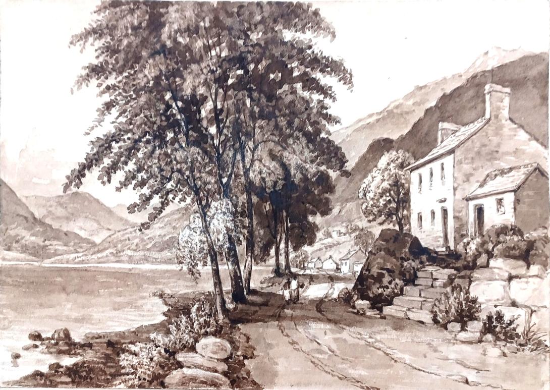
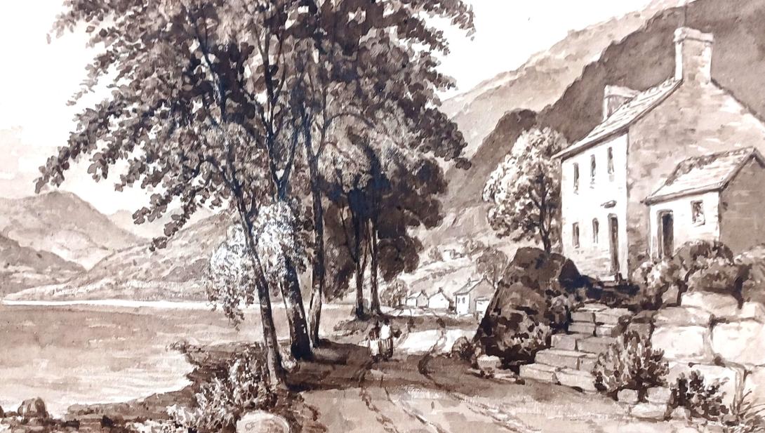
Francis William Staines was the last of a family of merchants from the City of London. Not only was he a successful businessman but he possessed a large independent fortune, such that he could devote his time to the cultivation of his talents in music and art. He was a brilliant amateur violinist, and also loved to spend much of his time painting. His daughter Amelia and her mother accompanied Mr Staines as he travelled throughout the country finding subjects for his painting. One area of the country that they visited frequently was Scotland and the Lake District, and Amelia grew particularly fond of the dramatic landscape of the Fells. Skelwith Bridge with the view of the hills around it 43 was one of her father’s favourite scenes. He painted landscapes and maritime paintings , exhibited 11 works at the RA including views on the Italian Coast, address in London, Hastings and St Leonards on Sea Susssex.