" P Yates" and inscribed on the reverse
Artà is one of the 53 independent municipalities on the Spanish Balearic island of Majorca. The small town of the same name is the administrative seat of this municipality in the region (Comarca) of Llevant.
Artà lies in the northeast of the island of Majorca, around 60 km from the island's capital of Palma. The Massís d’Artà, the highest and most compact massif in the eastern mountain chain of the Serres de Llevant, occupies more than half the area of the municipality. The municipality is located on the western part of peninsula of Artà and is bordered in the west by the Bay of Alcúdia (Badia d’Alcúdia), and in the north by the Mediterranean sea where its coast lies opposite the neighbouring island of Menorca. The coast of Artà stretches for 25 kilometres and, so far, has escaped being developed.[2] Particularly noteworthy are the beach and sand dune formations of sa Canova d’Artà, the flat coastal strip near the settlement of Colònia de Sant Pere, the high rocky coves of the Cap de Ferrutx and a large number of smaller bays that extend from s’Arenalet des Verger to Cala Torta.
To the east and southeast the municipality of Artà is bordered by the communities of Capdepera and Son Servera. Until the 19th century both belonged, together with the district of Artà, to the so-called Peninsula of Artà. Hence why the caves on the east coast of Majorca in the municipality of Capdepera are called the Caves of Artà (Coves d' Artà).
To the southwest are the municipalities of Sant Llorenç des Cardassar and Petra. The Torrent de na Borges, with its hamlet of Son Serra de Marina, forms the western border of Artà with the municipality of Santa Margalida.
Eight moderate to high hills belong to the municipality of Artà, the Puig Morei (also Puig d’en Morell or Talaia Freda) at 561 metres being the highest and the Puig d'en Mir being the lowest at 256 metres. The municipality is characterized by extensive areas of uninhabited terrain, especially in the regions in the mountains of the Serres de Llevant. Today, this natural region has become very barren as a result of numerous forest fires in recent years.
The area of the Caps de Ferrutx, with its rocky coves provides the osprey and peregrine falcon, for example, an ideal refuge. The northern coastal region is also home to feral goats. In the valleys of the Massis d’Artà, also called the Serra Artana, there are small groves of holly oak, enclosed by dry stone walls, where almond, fig and carob trees are cultivated.
Orchards of olive trees predominate in the hills, growing on steep slopes retained by dry stone walls. Large beds of reed are found amongst the natural vegetation along with fan palms (Chamaerops humilis) typical of the region, low clumps of luxuriant shrubs, wild olive trees and isolated pine woods. The fan palm is still a primary raw material for the basket makers on Majorca.
Rainfall is recorded in Artà all year round. The driest month is July with an average of 8.8 l/m2. October records the highest rainfall with an average of 101.3 l/m2. 1945 was the wettest year with 224.3 l/m2. Artà was first mentioned in 1232 under the name Yartân in the Llibre de repartiment de mallorca (Jaume I). Later it was also written down as Jartan or Jertan. The origin of the name is derived from "Gertan", the Arab word for garden.
This extraordinary landscape has been inhabited since the colonization of Majorca, as witnessed by the archaeological finds in this area:Ses Païsses and Sa Canova. They date from the time 1300–100 BC. The coins, seals and vessels of the Talaiotic culture may be seen in the Artà Regional Museum at Plaça d'Espanya.
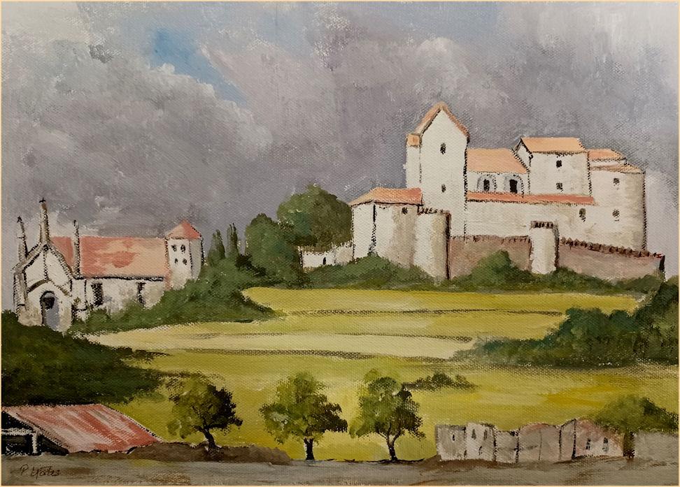
Little is known about the Artà region from the Roman or pre-Islamic period. It is believed, however, that the old fortress on the town's hill dates to before the Islamic-Arab possession of the island. In the Arabian era from the 10th to the 13th century and even during the early days of Catalan rule, the fortress was known as the Almudaina, which means something like "castle" or "fortress".
Today the one-meter thick fortress wall with its nine towers, including the main tower of Sant Miquel, surrounds the pilgrimage church of Santuari de Sant Salvador with its outbuildings. The church houses a multicoloured, carved, wooden, Romanesque statue of the Virgin Mary, which, according to the tradition of the White canons was brought to the island by James I during the conquest of Majorca.
A Calvary staircase of 180 steps links the parish church (Esglèsia Parroquial) of Transfiguració del Senyor at the foot of the town's hill with the 1832 baroque church of Sant Salvador on the 182-metre high Calvary Hill or Puig de Sant Salvador. The 1573 late Gothic style church of La Transfiguració replaced the ancient parish church consecrated in 1248 on the site of an earlier mosque.
During the Arab or Moorish era the peninsula of Yartan was one of thirteen districts of Majorca. After the Catalan conquest of the island the present town of Artà emerged in the 13th century after the arrival of the Norbertines, or White Monks, who founded the Priory of Santa Maria del Bellpuig. The estate of Bellpuig is three miles southwest of Artà. From there, the present town area, the farms of Almudaina, were divided into lots and reallocated. The town was still called Almudaina in the 15th century, whilst the name Artà referred to the entire district.
From the 16th to the 18th century the population of the city rose sharply and, in addition to agriculture, it developed a textile industry. An outbreak of bubonic plague in 1820 caused a setback resulting in 1200 deaths. In the 19th century the districts of Capdepera and Son Servera were separated from Artà. The greater part of the territory of Artà at that time was in the hands of big landowners. Among the small farmers the craft of basket making from palm leaves developed as an invaluable source of secondary income. In 1880, the land at Devesa de Ferrutx on the Bay of Alcúdia was divided up and the coastal village of Colonia de Sant Pere was founded as an agricultural settlement. This quiet tourist resort has the second highest population in the municipality after the town of Arta.
The few villages in the municipality of Artà became well linked by roads in the 20th century, not least with a view to developing tourism, which is now the most important industry on the island. Nevertheless, large parts of the area are still virtually unspoilt due to its sparse settlement, which led to the designation of the nature reserve Parc Natural de la Península de Llevant in the north of the borough of Artà. The railway line from Palma via Manacor and Son Servera to Artà was opened in 1921 but no longer operates. However, there is a plan to re-open a service from Manacor, which should start during the next legislative session.