" P Yates" and inscribed on the reverse
Unframed
The Rhône is a major river in France and Switzerland, rising in the Alps and flowing west and south through Lake Geneva and southeastern France before discharging into the Mediterranean Sea. At Arles, near its mouth, the river divides into the Great Rhône and the Little Rhône. The resulting delta forms the Camargue region. The river's source is the Rhône Glacier, at the east edge of the Swiss canton of Valais. The glacier is part of the Saint-Gotthard Massif, which gives rise to three other major rivers: the Reuss, Rhine and Ticino. The Rhône is, with the Po and Nile, one of the three Mediterranean rivers with the largest water discharge.
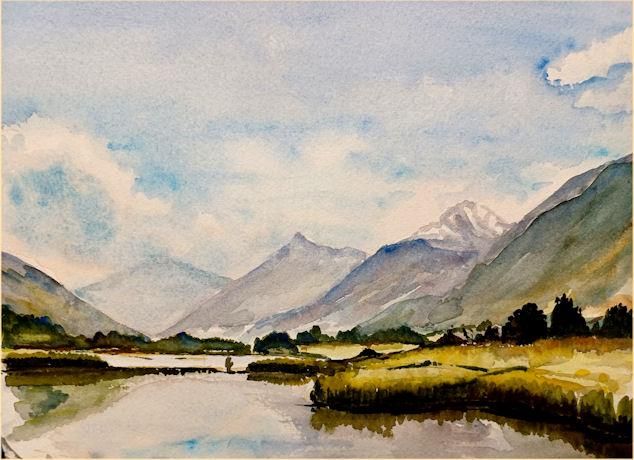
The Rhône begins as the meltwater of the Rhône Glacier in Valais, in the Swiss Alps, at an altitude of approximately 2,208 metres (7,244 ft). From there it flows southwest through Gletsch and the Goms, the uppermost valley region of the Valais before Brig. In the Brig area, it receives the waters of the Massa from the Aletsch Glacier, the longest glacier of the Alps, and shortly after, it receives the waters of the Vispa, the longest affluent in Valais. After that, it flows onward through the valley which bears its name and runs initially in a westerly direction about thirty kilometers to Leuk, then southwest about fifty kilometers to Martigny.
Down as far as Brig, the Rhône is a torrent; it then becomes a great mountain river running southwest through a glacial valley. Between Brig and Martigny, it collects waters mostly from the valleys of the Pennine Alps to the south, whose rivers originate from the large glaciers of the massifs of Monte Rosa, Dom, and Grand Combin, but also from the steeper slopes of the Bernese Alps to the north, and the Mont Blanc massif to the west. As a result, the Rhône Valley experiences a drier climate than the rest of Switzerland, being sheltered by the three highest ranges of the Alps, making Valais the driest and largest wine region of the country.
At Martigny, where it receives the waters of the Drance on its left bank, the Rhône makes a sharp turn towards the north. Heading toward Lake Geneva (French: Le Léman), the valley narrows near Saint-Maurice, a feature that has long given the Rhône valley strategic importance for the control of the Alpine passes. The Rhône then marks the boundary between the cantons of Valais (left bank) and Vaud (right bank), separating two parts of the historical region of Chablais. It then enters Lake Geneva near Le Bouveret, where the water flows west.
On the left (south) bank of Lake Geneva, the river Morge joins at the village of Saint-Gingolph, and also marks the French-Swiss border. Westward, the Dranse (unrelated to the Drance) enters the lake with its preserved delta, and then the Hermance marks another French-Swiss border. Between the Morge and Hermance, the lake is divided by the two countries along its centreline, with the left bank in France. The remainder of the lake is Swiss, including the entire right (north) bank. Here, the tributaries are the Veveyse, the Venoge, the Aubonne, the Morges, among other smaller rivers.
Lake Geneva ends in the city of Geneva, where the lake level is controlled by the Le Seujet dam . The average discharge from Lake Geneva is 251 cubic metres per second (8,900 cu ft/s). Below the dam, the Rhône receives the waters of the Arve, fed by the Mont Blanc massif, with a visibly higher sediment load and much lower temperature.
After a total of 290 kilometres (180 mi) in Switzerland, the Rhône continues west, entering France and the southern Jura Mountains. It turns toward the south, past Lac de Bourget, which the Rhône drains via the Canal de Savières. Continuing generally westward, the Rhône then receives the waters of the Valserine, enters the reservoir created by the Génissiat Dam, and is then joined by the Ain.
Reaching Lyon, the most populous city on its course, the Rhône receives its biggest tributary, the Saône, with an average flow of 473 m3/s (16,700 cu ft/s), compared to the Rhône's 600 m3/s (21,000 cu ft/s) at this point. From this confluence, the Rhône follows a southward course. Along the Rhône Valley, it is joined on the right (western) bank by the rivers Eyrieux, Ardèche, Cèze, and Gardon coming from the Cévennes mountains; and on the left bank by the rivers Isère, (with an average discharge of 333 m3/s (11,800 cu ft/s)), Drôme, Ouvèze, and Durance (188 m3/s (6,600 cu ft/s)) from the Alps.
From Lyon, the Rhône flows south, in its large valley between the Alps and the Massif Central. At Arles, the Rhône divides into two major arms forming the Camargue delta, both branches flowing into the Mediterranean Sea, the delta being termed the Rhône Fan. The larger arm is called the "Grand Rhône", the smaller the "Petit Rhône". The average annual discharge at Beaucaire is 1,700 m3/s (60,000 cu ft/s).